
IMAGES TAKEN NEAR TO
Stanley, PERTH, PH1 4QD
Introduction
This page details the photographs taken nearby to PH1 4QD by members of the Geograph project.
The Geograph project started in 2005 with the aim of publishing, organising and preserving representative images for every square kilometre of Great Britain, Ireland and the Isle of Man.

There are currently over 7.5m images from over14,400 individuals and you can help contribute to the project by visiting https://www.geograph.org.uk
Image Map
Images are licensed for reuse under creativecommons.org/licenses/by-sa/2.0
Notes
- Clicking on the map will re-center to the selected point.
- The higher the marker number, the further away the image location is from the centre of the postcode.
Image Listing (6 Images Found)
Images are licensed for reuse under creativecommons.org/licenses/by-sa/2.0
Image
Details
Distance
1
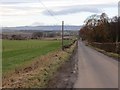
Road, Over Benchill
Approaching Five Mile Wood.
Image: © Richard Webb
Taken: 30 Nov 2013
0.09 miles
2
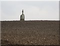
Over Benchil standing stone.
A large standing stone in a barley field. It is topped by a classical sandstone structure, according to one site I read it is a sundial.
Image: © Richard Webb
Taken: 24 Feb 2007
0.13 miles
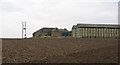
4
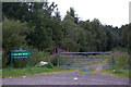
Entrance to Five Mile Wood, Stanley
Image: © Mike Pennington
Taken: 31 Jul 2011
0.15 miles
5
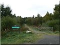
Entrance to Five Mile Wood
Track leading into an area of Forestry Commission woodland.
Image: © James Allan
Taken: 24 Sep 2007
0.16 miles
6
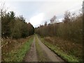
Road into Five Mile Wood
A popular path into a mostly conifer wood. (Core path STAN/142)
Image: © Richard Webb
Taken: 30 Nov 2013
0.18 miles