IMAGES TAKEN NEAR TO
Murthly, PERTH, PH1 4HA
Introduction
This page details the photographs taken nearby to PH1 4HA by members of the Geograph project.
The Geograph project started in 2005 with the aim of publishing, organising and preserving representative images for every square kilometre of Great Britain, Ireland and the Isle of Man.

There are currently over 7.5m images from over14,400 individuals and you can help contribute to the project by visiting https://www.geograph.org.uk
Image Map
Images are licensed for reuse under creativecommons.org/licenses/by-sa/2.0
Notes
- Clicking on the map will re-center to the selected point.
- The higher the marker number, the further away the image location is from the centre of the postcode.
Image Listing (17 Images Found)
Images are licensed for reuse under creativecommons.org/licenses/by-sa/2.0
Image
Details
Distance
1
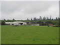
Baldarroch Farm
Baldarroch Farm viewed from the east.
Image: © Scott Cormie
Taken: 19 May 2019
0.02 miles
3
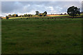
Fields south of Baldarroch Farm, Murthly
Image: © Mike Pennington
Taken: 16 Oct 2011
0.06 miles
4
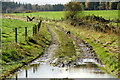
Farm track south of Baldarroch Farm, Murthly
Image: © Mike Pennington
Taken: 16 Oct 2011
0.06 miles
5
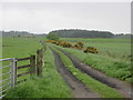
Track near Baldarroch
Track leading south from the roadside at Baldarroch Farm.
Image: © Scott Cormie
Taken: 19 May 2019
0.07 miles
7
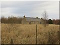
Wester Brownmuir
Ruin on newly wooded land.
Image: © Richard Webb
Taken: 30 Nov 2013
0.14 miles
8
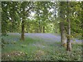
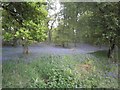
Bluebell Woods Next To Blairgowrie
Bluebell Woods In Perthshire, Scotland
Image: © Stevan Hogg
Taken: 5 Jun 2013
0.14 miles
9
Bluebell Woods In Perthshire
Bluebell Woods Next To Kinclaven, Perthire In Scotland.
http://www.facebook.com/stevanhogg1
Image: © Stevan Hogg
Taken: 5 Jun 2013
0.14 miles
10
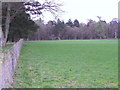
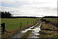
Field boundary near Ardoch
The field boundary with Old England Wood.
Image: © Maigheach-gheal
Taken: 13 Apr 2011
0.15 miles