IMAGES TAKEN NEAR TO
Abernyte, PERTH, PH14 9TA
Introduction
This page details the photographs taken nearby to PH14 9TA by members of the Geograph project.
The Geograph project started in 2005 with the aim of publishing, organising and preserving representative images for every square kilometre of Great Britain, Ireland and the Isle of Man.

There are currently over 7.5m images from over14,400 individuals and you can help contribute to the project by visiting https://www.geograph.org.uk
Image Map
Images are licensed for reuse under creativecommons.org/licenses/by-sa/2.0
Notes
- Clicking on the map will re-center to the selected point.
- The higher the marker number, the further away the image location is from the centre of the postcode.
Image Listing (10 Images Found)
Images are licensed for reuse under creativecommons.org/licenses/by-sa/2.0
Image
Details
Distance
1
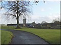
Parallel tree and silo
Lochton Farm on a windy autumn day.
Image: © James Allan
Taken: 27 Nov 2006
0.08 miles
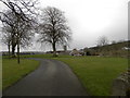
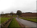
3
Road at Lochton
The minor road heading southwards through the Sidlaws at Lochton.
Image: © Scott Cormie
Taken: 5 May 2018
0.13 miles
4
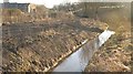
Lochton Burn
Widened and straightened. Drainage improvement at Lochton.
Image: © Richard Webb
Taken: 29 Jan 2010
0.17 miles
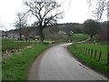
5
Minor road near Lochton Farm
The road crosses Lochton Burn at the short chicane.
Image: © Douglas Nelson
Taken: 13 Apr 2016
0.17 miles
6
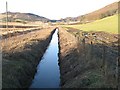
Lochton Burn
The burn has been deepened and straightened to act as a drainage ditch. Looking upstream towards Glen Bran.
Image: © Richard Webb
Taken: 29 Jan 2010
0.17 miles
7
Gallows Knowe
Sadly, all too common a place name. A bend in the road over the Sidlaw Hills via Ballo Glack.
Image: © Richard Webb
Taken: 29 Jan 2010
0.18 miles
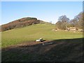
8
Road to Glenbran
Farm drive leading towards King's Seat, one of the more distinct hills in the Sidlaw range.
Image: © Richard Webb
Taken: 29 Jan 2010
0.19 miles
9
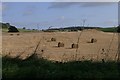
Fields at Dundriven, north of Abernyte
Image: © Mike Pennington
Taken: 11 Oct 2008
0.24 miles
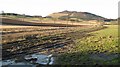
10
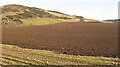
Ploughed field by Dundriven
Arable land under Southballo Hill.
Image: © Richard Webb
Taken: 29 Jan 2010
0.25 miles