IMAGES TAKEN NEAR TO
Inchture, PERTH, PH14 9QP
Introduction
This page details the photographs taken nearby to PH14 9QP by members of the Geograph project.
The Geograph project started in 2005 with the aim of publishing, organising and preserving representative images for every square kilometre of Great Britain, Ireland and the Isle of Man.

There are currently over 7.5m images from over14,400 individuals and you can help contribute to the project by visiting https://www.geograph.org.uk
Image Map
Images are licensed for reuse under creativecommons.org/licenses/by-sa/2.0
Notes
- Clicking on the map will re-center to the selected point.
- The higher the marker number, the further away the image location is from the centre of the postcode.
Image Listing (11 Images Found)
Images are licensed for reuse under creativecommons.org/licenses/by-sa/2.0
Image
Details
Distance
2
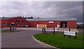
Little Powgavie
Little Powgavie is the base of Broomhall Feeds, which supplies feed for livestock and pets.
Image: © Anne Burgess
Taken: 16 Nov 2017
0.03 miles
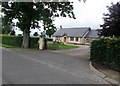
4
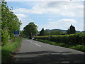
Road junction near Little Powgavie
Joining minor road between Inchture and Errol.
Image: © Stanley Howe
Taken: 28 Jun 2016
0.10 miles
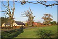
5
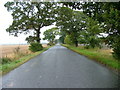
Going south from Inchture
Many roads south of the main Dundee to Perth road are like this, long and straight over the wetlands north of the River Tay.
Image: © Dave Fergusson
Taken: 27 Sep 2010
0.16 miles
6
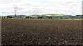
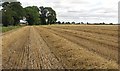
Ploughed field, Carse of Gowrie
Land already ploughed during the harvest season. It will be used to grow winter cereals, probably wheat.
Image: © Richard Webb
Taken: 25 Aug 2010
0.17 miles
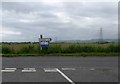
8
Heading to the level crossing between Exton and Little Powgavie
Image: © James Denham
Taken: 2 Jun 2010
0.22 miles
9
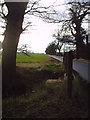
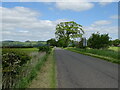
Drainage Ditch in the Carse of Gowrie
Between Perth and Dundee this little used road wanders along field boundaries in the flat flood plain of the River Tay. Its fertile soils are served by many drainage ditches, this one is particularly attractive, under a stand of old oak trees.
Image: © Dr Duncan Pepper
Taken: 1 Feb 2007
0.22 miles
10
Straw
Newly combined field, with rows of straw awaiting baling.
Image: © Richard Webb
Taken: 25 Aug 2010
0.23 miles