IMAGES TAKEN NEAR TO
Abernyte, PERTH, PH14 9PZ
Introduction
This page details the photographs taken nearby to PH14 9PZ by members of the Geograph project.
The Geograph project started in 2005 with the aim of publishing, organising and preserving representative images for every square kilometre of Great Britain, Ireland and the Isle of Man.

There are currently over 7.5m images from over14,400 individuals and you can help contribute to the project by visiting https://www.geograph.org.uk
Image Map
Images are licensed for reuse under creativecommons.org/licenses/by-sa/2.0
Notes
- Clicking on the map will re-center to the selected point.
- The higher the marker number, the further away the image location is from the centre of the postcode.
Image Listing (12 Images Found)
Images are licensed for reuse under creativecommons.org/licenses/by-sa/2.0
Image
Details
Distance
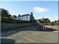
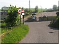
4
Junction in Abernyte
Signage points oppositely to Collace and to Inchture. Homes are evident as well.
Image: © C Michael Hogan
Taken: 3 Jul 2013
0.05 miles
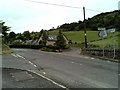
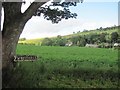
5
Junction of the kirk road and the B953 at Abernyte
Image: © James Denham
Taken: 4 Jun 2010
0.05 miles
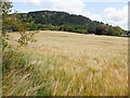
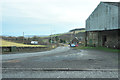
9
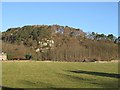
Kirkton Crag
Crag on wooded Kirkton Hill, Abernyte.
Image: © Richard Webb
Taken: 29 Jan 2010
0.17 miles
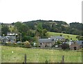
10
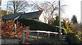
Telephone exchange, Abernyte
With telephone box.
Image: © Richard Webb
Taken: 29 Jan 2010
0.17 miles