
IMAGES TAKEN NEAR TO
Candlehouse Lane, BLAIRGOWRIE, PH13 9DD
Introduction
This page details the photographs taken nearby to Candlehouse Lane, PH13 9DD by members of the Geograph project.
The Geograph project started in 2005 with the aim of publishing, organising and preserving representative images for every square kilometre of Great Britain, Ireland and the Isle of Man.

There are currently over 7.5m images from over14,400 individuals and you can help contribute to the project by visiting https://www.geograph.org.uk
Image Map
Images are licensed for reuse under creativecommons.org/licenses/by-sa/2.0
Notes
- Clicking on the map will re-center to the selected point.
- The higher the marker number, the further away the image location is from the centre of the postcode.
Image Listing (76 Images Found)
Images are licensed for reuse under creativecommons.org/licenses/by-sa/2.0
Image
Details
Distance
1
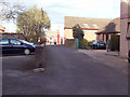
Candlehouse Lane
This lane was named after a candle factory which was situated here. The building still stands and stones from the abbey can be seen in its fabric. The abbey mill also stood nearby, drawing water from the Couper Burn.
Image: © Maigheach-gheal
Taken: 10 Apr 2007
0.01 miles
2
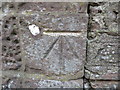
Ordnance Surcey Cut Mark with Bolt
This mark can be found on the wall of The Steeple in Queen Street, Coupar Angus. The Benchmark's recorded height is 54.703 metres above sea level.
For more detail see : https://www.bench-marks.org.uk/log?lg_key=182996
Image: © Peter Wood
Taken: 16 Nov 2019
0.03 miles
3
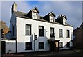
Former Strathmore Hotel
A Category B listed https://portal.historicenvironment.scot/designation/LB23129 18th century inn, which has been disused and empty since around 2005. It is in poor condition and is listed in the Buildings at Risk Register https://www.buildingsatrisk.org.uk/details/911650.
Image: © Richard Sutcliffe
Taken: 31 Oct 2023
0.03 miles
4
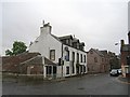
Strathmore Hotel
A closed hotel in Coupar Angus.
Image: © Richard Webb
Taken: 16 Sep 2012
0.03 miles
5
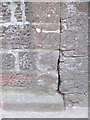
Bench Mark, Coupar Angus
The bench mark is to be found on the north east angle of The Steeple Image and http://www.bench-marks.org.uk/bm34280
A bench mark is an Ordnance Survey arrowhead sign found on walls, bridges, churches and specially erected triangulation pillars where the altitude above sea-level has been accurately measured by surveyors. The arrowhead points to a horizontal line above it which marks the exact altitude.
With rivets and pivots there is no datum (horizontal line) cut, the pointed-to horizontal surface defining the datum height.
Image: © Maigheach-gheal
Taken: 28 Mar 2010
0.04 miles
6
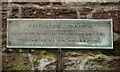
Tollbooth Steeple plaque
On the wall of the Category B listed https://portal.historicenvironment.scot/designation/LB23128 18th century tollbooth steeple Image
TOLLBOOTH STEEPLE
BUILT BY PUBLIC SUBSCRIPTION 1762
PRISON OF COURT OF REGALITY
See https://en.wikipedia.org/wiki/Regality for information about courts of regality.
Image: © Richard Sutcliffe
Taken: 31 Oct 2023
0.04 miles
7
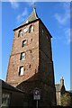
Tollbooth Steeple
Category B listed https://portal.historicenvironment.scot/designation/LB23128 tollbooth steeple on Queen Street, Coupar Angus. It dates from 1762.
Image: © Richard Sutcliffe
Taken: 31 Oct 2023
0.04 miles
8
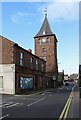
Tollbooth Steeple
Category B listed https://portal.historicenvironment.scot/designation/LB23128 tollbooth steeple on Queen Street, Coupar Angus. It dates from 1762.
Image: © Richard Sutcliffe
Taken: 31 Oct 2023
0.04 miles
9
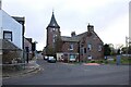
Queen Street, Coupar Angus
At the junction with the A94, Burnside Road. The Tollbooth Steeple Image dominates the scene. Stripping back the paintwork on the former shop at the corner sometime between 2012 and 2015 has revealed a ghost sign:
'--AIN & PRIVISION STORE'
Image: © Richard Sutcliffe
Taken: 31 Oct 2023
0.04 miles
10
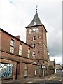
Tolbooth Steeple, Queen Street, Coupar Angus
The Tolbooth is a 6-storey red rubble tower and was built by public subscription in 1762 and completed in 1769. The Steeple was to serve as a jail on the ground floor and as a meeting house for local courts on the upper floors. It is a Category B listed building. https://www.britishlistedbuildings.co.uk/200358946-the-steeple-queen-street-strathmore-ward#.Wy44TjGWw5s
Image: © G Laird
Taken: 21 Jun 2018
0.05 miles