IMAGES TAKEN NEAR TO
Newtyle, BLAIRGOWRIE, PH12 8UP
Introduction
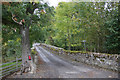
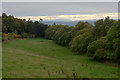
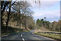
This page details the photographs taken nearby to PH12 8UP by members of the Geograph project.
The Geograph project started in 2005 with the aim of publishing, organising and preserving representative images for every square kilometre of Great Britain, Ireland and the Isle of Man.

There are currently over 7.5m images from over14,400 individuals and you can help contribute to the project by visiting https://www.geograph.org.uk
Image Map
Images are licensed for reuse under creativecommons.org/licenses/by-sa/2.0
Notes
- Clicking on the map will re-center to the selected point.
- The higher the marker number, the further away the image location is from the centre of the postcode.
Image Listing (4 Images Found)
Images are licensed for reuse under creativecommons.org/licenses/by-sa/2.0
Image
Details
Distance
4
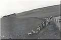
West flank of Hatton Hill
The track of the original Dundee to Newtyle Railway ran above the field wall on to the top of the Hatton Incline which was where the trees are on the horizon.
Image: © Elliott Simpson
Taken: Unknown
0.25 miles