IMAGES TAKEN NEAR TO
Meigle, BLAIRGOWRIE, PH12 8RA

Introduction

This page details the photographs taken nearby to PH12 8RA by members of the Geograph project.

The Geograph project started in 2005 with the aim of publishing, organising and preserving representative images for every square kilometre of Great Britain, Ireland and the Isle of Man.

There are currently over 7.5m images from over14,400 individuals and you can help contribute to the project by visiting https://www.geograph.org.uk

Image Map


Images are licensed for reuse under creativecommons.org/licenses/by-sa/2.0
Notes
  • Clicking on the map will re-center to the selected point.
  • The higher the marker number, the further away the image location is from the centre of the postcode.

Image Listing (12 Images Found)

Images are licensed for reuse under creativecommons.org/licenses/by-sa/2.0
Image
Details
Distance
1
Hallyards
Image: © Mike Pennington Taken: 30 Dec 2007
0.02 miles
2
Floods on the Isla beside Hallyards
Image: © Mike Pennington Taken: 29 Dec 2012
0.07 miles
3
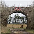
Old railway bridge in Strathmore
On the old branch line (long since closed) to Alyth, one of several railways which traversed Strathmore. Usually such bridges are demolished promptly once they are no longer required, as they constitute a maintenance liability.
Image: © Oliver Dixon Taken: 24 May 2006
0.16 miles
4
Field, Hallyards
The line of trees is an embankment on the railway which used to run to Alyth,
Image: © Richard Webb Taken: 29 Mar 2015
0.17 miles
5
Hallyards near Alyth
A Charolais beef farm. Hallyards farmhouse is out of sight in the background; the house which is visible is a new house on the farm premises.
Image: © Oliver Dixon Taken: 24 May 2006
0.19 miles
6
Bridge, Hallyards
A bridge once carried the Alyth Railway over a minor road.
Image: © Richard Webb Taken: 29 Mar 2015
0.21 miles
7
Old railway bridge
Still intact bridge, over the narrow minor road between Hallyards and Balendoch, that carried the railway line from Meigle to Alyth.
Image: © Scott Cormie Taken: 14 Oct 2018
0.21 miles
8
Minor road approaching bridge that used to carry railway traffic over it
Looking north-eastward.
Image: © Peter Wood Taken: 26 Jun 2019
0.22 miles
9
Ordnance Survey Cut Mark
This can be found on the roadside wall of a disused railway bridge near to Hallyards. The benchmark's recorded height is 39.862 metres above sea level. For more detail see : https://www.bench-marks.org.uk/bm109349
Image: © Peter Wood Taken: 26 Jun 2019
0.22 miles
10
Metric or Imperial it is the same
Bridge under the dismantled Meigle to Alyth railway.The track now carries an overgrown footpath.
Image: © Ian Murfitt Taken: 19 Aug 2011
0.23 miles