IMAGES TAKEN NEAR TO
PERTH, PH1 1QS
Introduction
This page details the photographs taken nearby to PH1 1QS by members of the Geograph project.
The Geograph project started in 2005 with the aim of publishing, organising and preserving representative images for every square kilometre of Great Britain, Ireland and the Isle of Man.

There are currently over 7.5m images from over14,400 individuals and you can help contribute to the project by visiting https://www.geograph.org.uk
Image Map
Images are licensed for reuse under creativecommons.org/licenses/by-sa/2.0
Notes
- Clicking on the map will re-center to the selected point.
- The higher the marker number, the further away the image location is from the centre of the postcode.
Image Listing (12 Images Found)
Images are licensed for reuse under creativecommons.org/licenses/by-sa/2.0
Image
Details
Distance
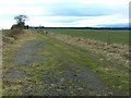
1
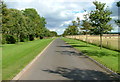
New road to Clathymore
This single track road leads to a rather exclusive looking housing development at Clathymore.
Image: © Dave Fergusson
Taken: 5 Sep 2011
0.03 miles
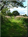
3
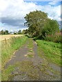
Old road to Clathymore
A new road has been constructed to serve the rather exclusive looking housing development that has appeared.
Image: © Dave Fergusson
Taken: 5 Sep 2011
0.10 miles
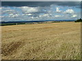
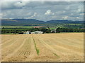
6
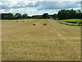
Straw bales at Findo Gask
On the right is the Findo Gask to Balgowan road.
Image: © Dave Fergusson
Taken: 5 Sep 2011
0.17 miles
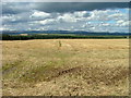
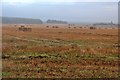
9
Straw awaiting the baler
The farm is Innergask.
Image: © Dave Fergusson
Taken: 5 Sep 2011
0.19 miles
10
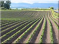
Potato field, Clathybeg
The potato plants have emerged from the rigs.
Image: © Richard Webb
Taken: 27 May 2007
0.19 miles