IMAGES TAKEN NEAR TO
Tibbermore, PERTH, PH1 1PY
Introduction
This page details the photographs taken nearby to PH1 1PY by members of the Geograph project.
The Geograph project started in 2005 with the aim of publishing, organising and preserving representative images for every square kilometre of Great Britain, Ireland and the Isle of Man.

There are currently over 7.5m images from over14,400 individuals and you can help contribute to the project by visiting https://www.geograph.org.uk
Image Map
Images are licensed for reuse under creativecommons.org/licenses/by-sa/2.0
Notes
- Clicking on the map will re-center to the selected point.
- The higher the marker number, the further away the image location is from the centre of the postcode.
Image Listing (6 Images Found)
Images are licensed for reuse under creativecommons.org/licenses/by-sa/2.0
Image
Details
Distance
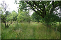
1
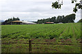
Southton of Blackruthven, near Perth
Image: © Mike Pennington
Taken: 7 Aug 2013
0.05 miles
2
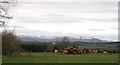
Southton of Blackruthven
Cattle feeding in fields edged with woodland behind Southton of Blackruthven farm. Methven Castle can be seen in the distance.
Image: © Jackie Proven
Taken: 27 Nov 2005
0.11 miles
3
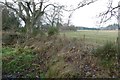
Southton of Blackruthven
North of the Old Gallows Road.
Image: © Richard Webb
Taken: 15 Dec 2016
0.18 miles
4
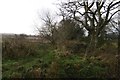
The Old Gallows Road
An old drove road from the west into Perth.
Image: © Richard Webb
Taken: 15 Dec 2016
0.19 miles
5
Path near Southton of Blackruthven, near Perth
An extension of the Old Gallows Road.
Image: © Mike Pennington
Taken: 7 Aug 2013
0.20 miles
6
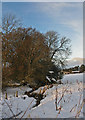
The Scouring Burn near Southton of Blackruthven farm
A minor tributary of the River Tay pictured here in midwinter
Image: © William Starkey
Taken: 9 Dec 2010
0.22 miles