IMAGES TAKEN NEAR TO
Glenisla, BLAIRGOWRIE, PH11 8PN

Introduction

This page details the photographs taken nearby to PH11 8PN by members of the Geograph project.

The Geograph project started in 2005 with the aim of publishing, organising and preserving representative images for every square kilometre of Great Britain, Ireland and the Isle of Man.

There are currently over 7.5m images from over14,400 individuals and you can help contribute to the project by visiting https://www.geograph.org.uk

Image Map


Images are licensed for reuse under creativecommons.org/licenses/by-sa/2.0
Notes
  • Clicking on the map will re-center to the selected point.
  • The higher the marker number, the further away the image location is from the centre of the postcode.

Image Listing (11 Images Found)

Images are licensed for reuse under creativecommons.org/licenses/by-sa/2.0
Image
Details
Distance
1
Minor road between Auchenleish Farm and Auchenleish House
Looking westward.
Image: © Peter Wood Taken: 23 Jun 2019
0.08 miles
2
Cottage at Auchenleish
Farm cottage in Glen Isla. Mount Blair Image on the skyline.
Image: © Oliver Dixon Taken: 17 Mar 2012
0.10 miles
3
Minor road near Auchenleish Farm
Looking south-eastward.
Image: © Peter Wood Taken: 23 Jun 2019
0.11 miles
4
Felled forest at Auchenleish
Cleared forest on the hillside west of Auchenleish Farm.
Image: © Scott Cormie Taken: 15 Jul 2018
0.12 miles
5
Foxgloves along a dyke, Auchinleish, Glen Isla
Looking towards Cairn Gibbs.
Image: © Mike Pennington Taken: 6 Aug 2009
0.14 miles
6
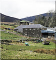
Stone-built barns at Auchenleish Farm
Stone-built, slate-roofed barns at the farm; there are modern examples and the farmhouse out of view to the right. Meall Mòr is the hill on the horizon.
Image: © Trevor Littlewood Taken: 13 Apr 2022
0.15 miles
7
Cleared woodland, Auchinleish, Glen Isla
The small wood shown on the map has now been cleared, although apparently not for forestry.
Image: © Mike Pennington Taken: 6 Aug 2009
0.15 miles
8
Cleared woodland at Auchenleish
Looking up the Cressfit Burn. Cairn Gibbs Image on the skyline to the right.
Image: © Oliver Dixon Taken: 17 Mar 2012
0.15 miles
9
Newly cut green field
A newly cut field at Auchenleish.
Image: © Scott Cormie Taken: 15 Jul 2018
0.16 miles
10
Hill road climbing into valley of Cressfit Burn
The stream drains slopes of the moorland hills, Cairn Gibbs and Knockton. The way initially is unattractive passing apparently abandoned farm equipment and various debris.
Image: © Trevor Littlewood Taken: 13 Apr 2022
0.22 miles