IMAGES TAKEN NEAR TO
Alyth, BLAIRGOWRIE, PH11 8JP
Introduction
This page details the photographs taken nearby to PH11 8JP by members of the Geograph project.
The Geograph project started in 2005 with the aim of publishing, organising and preserving representative images for every square kilometre of Great Britain, Ireland and the Isle of Man.

There are currently over 7.5m images from over14,400 individuals and you can help contribute to the project by visiting https://www.geograph.org.uk
Image Map
Images are licensed for reuse under creativecommons.org/licenses/by-sa/2.0
Notes
- Clicking on the map will re-center to the selected point.
- The higher the marker number, the further away the image location is from the centre of the postcode.
Image Listing (6 Images Found)
Images are licensed for reuse under creativecommons.org/licenses/by-sa/2.0
Image
Details
Distance
1

Kelvin, near Alyth
A house to the east of Alyth.
Image: © Mike Pennington
Taken: 4 Aug 2007
0.00 miles
2
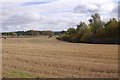
Stubble by Kelvin
A field with some irregular recent tree plantations.
Image: © Richard Webb
Taken: 29 Sep 2018
0.07 miles
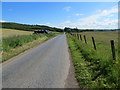
3
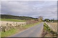
Balloch and Bruceton road
Running along the north side of the Isla.
Image: © Richard Webb
Taken: 29 Sep 2018
0.10 miles
4
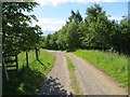
Farm track leading to Inverquiech
Looking south-eastward.
Image: © Peter Wood
Taken: 26 Jun 2019
0.18 miles
5
Minor road and arable fields between Kelvin and Cult
Looking north-eastward.
Image: © Peter Wood
Taken: 26 Jun 2019
0.21 miles