IMAGES TAKEN NEAR TO
Victoria Place, BLAIRGOWRIE, PH10 7HL

Introduction

This page details the photographs taken nearby to Victoria Place, PH10 7HL by members of the Geograph project.

The Geograph project started in 2005 with the aim of publishing, organising and preserving representative images for every square kilometre of Great Britain, Ireland and the Isle of Man.

There are currently over 7.5m images from over14,400 individuals and you can help contribute to the project by visiting https://www.geograph.org.uk

Image Map


Images are licensed for reuse under creativecommons.org/licenses/by-sa/2.0
Notes
  • Clicking on the map will re-center to the selected point.
  • The higher the marker number, the further away the image location is from the centre of the postcode.

Image Listing (47 Images Found)

Images are licensed for reuse under creativecommons.org/licenses/by-sa/2.0
  • ...
Image
Details
Distance
1
Blairgowrie at twilight from Bonnington
Image: © David Martin Taken: 23 Dec 2008
0.03 miles
2
Victoria Street, Rattray
A dead end for motors, but there is a path out at the end of the rear right turn.
Image: © Richard Webb Taken: 29 Sep 2018
0.04 miles
3
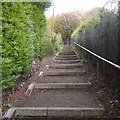
Steps, Rattray
A path connecting Hatton Road with Victoria Street. There are ramps for wheeling a bike, but these are often blocked by vegetation, either at ground level or protruding from the hedge.
Image: © Richard Webb Taken: 29 Sep 2018
0.05 miles
4
Spar, Rattray
The only supermarket left in Rattray; all the other shops are across the bridge in Blairgowrie.
Image: © Mike Pennington Taken: 10 Feb 2008
0.07 miles
5
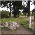
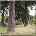
Entrance to the Marfield, Hatton Road
There are the remains of a sign on one of the trees - once there was a back entrance to the Marfield pub, demolished in 2008.
Image: © Richard Webb Taken: 29 Sep 2018
0.08 miles
6
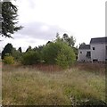
Unused ground, Hatton Road
Beside the remains of a driveway Image], these were the grounds of the Marfield, a closed pub which was demolished in 2008..
Image: © Richard Webb Taken: 29 Sep 2018
0.08 miles
7
A lost driveway, Hatton Road
There are the remains of a sign on one of the trees - once there was a back entrance to the Marfield pub, demolished in 2008.
Image: © Richard Webb Taken: 29 Sep 2018
0.08 miles
8
Marfield public house
In Ferguson Park in Rattray; disused and scheduled for demolition.
Image: © Mike Pennington Taken: 10 Feb 2008
0.12 miles
9
Footpath near River Ericht
Image: © Bartolo Creations Taken: 5 Oct 2022
0.14 miles
10
River Ericht at Blairgowrie
Image: © nick macneill Taken: 4 Sep 2011
0.15 miles
  • ...