
IMAGES TAKEN NEAR TO
Rattray, BLAIRGOWRIE, PH10 7HF
Introduction
This page details the photographs taken nearby to PH10 7HF by members of the Geograph project.
The Geograph project started in 2005 with the aim of publishing, organising and preserving representative images for every square kilometre of Great Britain, Ireland and the Isle of Man.

There are currently over 7.5m images from over14,400 individuals and you can help contribute to the project by visiting https://www.geograph.org.uk
Image Map
Images are licensed for reuse under creativecommons.org/licenses/by-sa/2.0
Notes
- Clicking on the map will re-center to the selected point.
- The higher the marker number, the further away the image location is from the centre of the postcode.
Image Listing (7 Images Found)
Images are licensed for reuse under creativecommons.org/licenses/by-sa/2.0
Image
Details
Distance
1
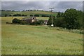
Pondfauld
The former berrypickers cottages beside the main house are now holiday accommodation.
Image: © Mike Pennington
Taken: 14 Jul 2008
0.01 miles
2
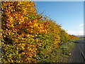
Beech hedge, Rattray, Blairgowrie
Heading out of Rattray on a beautiful autumn morning. The road is the A926 heading to Alyth.
Image: © Dona Robbins
Taken: 28 Oct 2010
0.09 miles
3
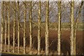
Poplars at Rattray
A shelterbelt of Lombardy poplars.
Image: © Mike Pennington
Taken: 23 Dec 2007
0.14 miles
4
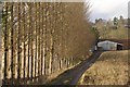
Shelterbelt at Rattray
A line of Lombardy poplars on the eastern edge of Rattray.
Image: © Mike Pennington
Taken: 23 Dec 2007
0.17 miles
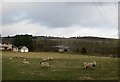
6
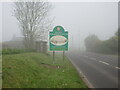
Approaching Blairgowrie and Rattray in the fog
Blairgowrie & Rattray welcome sign on the A926 in misty conditions.
Image: © Scott Cormie
Taken: 30 May 2021
0.24 miles
7
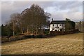
House at Rattray
One of the last houses on the eastern edge of Rattray; the Rattray church manse
Image: © Mike Pennington
Taken: 23 Dec 2007
0.25 miles