IMAGES TAKEN NEAR TO
BLAIRGOWRIE, PH10 6TA
Introduction
This page details the photographs taken nearby to PH10 6TA by members of the Geograph project.
The Geograph project started in 2005 with the aim of publishing, organising and preserving representative images for every square kilometre of Great Britain, Ireland and the Isle of Man.

There are currently over 7.5m images from over14,400 individuals and you can help contribute to the project by visiting https://www.geograph.org.uk
Image Map
Images are licensed for reuse under creativecommons.org/licenses/by-sa/2.0
Notes
- Clicking on the map will re-center to the selected point.
- The higher the marker number, the further away the image location is from the centre of the postcode.
Image Listing (74 Images Found)
Images are licensed for reuse under creativecommons.org/licenses/by-sa/2.0
Image
Details
Distance
1
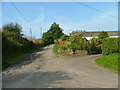
Road to East Gormack Farm
From its junction with the Lornty road.The farm road is also part of the Cateran Trail.
Image: © Dave Fergusson
Taken: 23 Sep 2012
0.02 miles
2
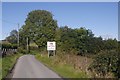
Road, Lornty
The sign is a countermeasure against the sat-navs. Good luck getting an HGV out from there, they mean it!
Image: © Richard Webb
Taken: 2 Oct 2016
0.03 miles
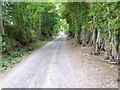
3

The road to Lornty
North of Blairgowrie.
Image: © Dave Fergusson
Taken: 23 Sep 2012
0.04 miles
4
Cateran Trail, Lornty
The 64 mile trail uses this farm road at Knockie to take walkers towards the Bridge of Cally.
Image: © Maigheach-gheal
Taken: 28 Sep 2009
0.06 miles
5
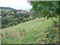
Rough grazing, Lornty
Small steep fields of rough grazing run down towards the River Ericht and the town of Blairgowrie.
Image: © Maigheach-gheal
Taken: 28 Sep 2009
0.06 miles
6
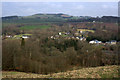
View across the Ericht from Knockie, Blairgowrie
Looking across to the hill of Broad Moss.
Image: © Mike Pennington
Taken: 31 Mar 2014
0.07 miles
7
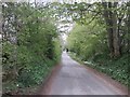
Leafy lane to Blairgowrie
Road heading south towards Blairgowrie, now part of the Cateran Trail.
Image: © Scott Cormie
Taken: 5 May 2019
0.09 miles
8
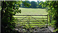
Gate north of Blairgowrie
Along the River Ericht path north of the town.
Image: © Mike Pennington
Taken: 25 Jul 2008
0.12 miles
9
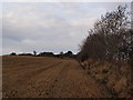
Field of stubble
The field is just beside the farm road forming part of the Knockie path and the Cateran Trail.
Image: © Alec MacKinnon
Taken: 17 Dec 2016
0.12 miles
10
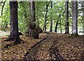
Track through woodland near Blairgowrie
Image: © Tom Pennington
Taken: 20 Sep 2006
0.12 miles