
IMAGES TAKEN NEAR TO
Burnhead Road, BLAIRGOWRIE, PH10 6SY
Introduction
This page details the photographs taken nearby to Burnhead Road, PH10 6SY by members of the Geograph project.
The Geograph project started in 2005 with the aim of publishing, organising and preserving representative images for every square kilometre of Great Britain, Ireland and the Isle of Man.

There are currently over 7.5m images from over14,400 individuals and you can help contribute to the project by visiting https://www.geograph.org.uk
Image Map
Images are licensed for reuse under creativecommons.org/licenses/by-sa/2.0
Notes
- Clicking on the map will re-center to the selected point.
- The higher the marker number, the further away the image location is from the centre of the postcode.
Image Listing (26 Images Found)
Images are licensed for reuse under creativecommons.org/licenses/by-sa/2.0
Image
Details
Distance
1
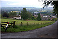
Blairgowrie from the top of Newton Street
Image: © Mike Pennington
Taken: 15 Jul 2011
0.10 miles
2
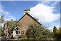
Northfield, Keay Street
Northfield, Keay Street in Blairgowrie
Image: © Graeme Smith
Taken: 10 Jun 2004
0.10 miles
3
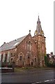
St Mary's Church, Blairgowrie ( now disused)
Reform Street.
Image: © Bill Henderson
Taken: Unknown
0.11 miles
4
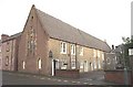
St Stephen's Roman Catholic Church, Blairgowrie.
John Street.
Image: © Bill Henderson
Taken: Unknown
0.11 miles
5
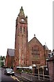
The Parish Church, Blairgowrie
St Andrew's, James Street.
Image: © Bill Henderson
Taken: Unknown
0.11 miles
6
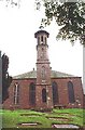
The old Presbyterian 'Hill Church', Blairgowrie
Now disused as a church, but used by Blairgowrie Players as a rehearsal space. See http://www.blairgowrieplayers.co.uk/news.htm .
Image: © Bill Henderson
Taken: Unknown
0.11 miles
7
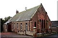
Blairgowrie, the Evangelical Church
In Kirk Wynd.
Image: © Bill Henderson
Taken: Unknown
0.11 miles
8
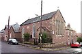
St Catharine's Episcopal Church, Blairgowrie
Image: © Bill Henderson
Taken: Unknown
0.11 miles
9
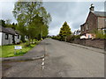
Newton Road, looking northwest
From its junction with Newton Terrace.
Image: © James Allan
Taken: 13 May 2013
0.13 miles
10
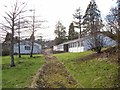
Hill Primary School, former outbuildings
Hill Primary School closed in 2009. Main building: Image The buildings photographed here, located in Newton Terrace, were part of the school. One still bears a sign stating it to be the Nursery Class. The other, is currently in use as the Rowanbank Community Learning Base.
Image: © Richard Dorrell
Taken: 24 Feb 2013
0.13 miles