IMAGES TAKEN NEAR TO
Perth Street, BLAIRGOWRIE, PH10 6DQ
Introduction
This page details the photographs taken nearby to Perth Street, PH10 6DQ by members of the Geograph project.
The Geograph project started in 2005 with the aim of publishing, organising and preserving representative images for every square kilometre of Great Britain, Ireland and the Isle of Man.

There are currently over 7.5m images from over14,400 individuals and you can help contribute to the project by visiting https://www.geograph.org.uk
Image Map
Images are licensed for reuse under creativecommons.org/licenses/by-sa/2.0
Notes
- Clicking on the map will re-center to the selected point.
- The higher the marker number, the further away the image location is from the centre of the postcode.
Image Listing (200 Images Found)
Images are licensed for reuse under creativecommons.org/licenses/by-sa/2.0
Image
Details
Distance
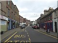
2
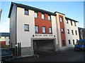
Picture House Court, Blairgowrie
Recent housing.
Image: © Jonathan Thacker
Taken: 4 Dec 2013
0.05 miles
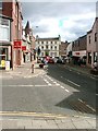
3
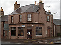
SNP offices, Blairgowrie
The Blairgowrie offices of the Scottish National Party are at the junction of Newton and Perth Streets.
Image: © Trevor Littlewood
Taken: 29 Oct 2011
0.06 miles
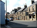
4
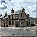
Corner of Perth Street and Newton Street
Image: © Ian Hawfinch
Taken: 27 Jun 2021
0.06 miles
8
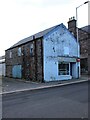
Former shop
On the corner of Reform Street and Union Street, Blairgowrie.
Image: © Richard Sutcliffe
Taken: 31 Oct 2023
0.07 miles
9
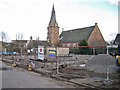
Army Cadet Drill Hall site, Union Street
The former drill hall of the Blairgowrie Detachment of the Black Watch Battalion Army Cadet Force which stood on this site was demolished in late 2012, and a new Drill Hall is currently under construction on the same site. The work provides a view of the now disused St Mary's Church, located in Reform Street. The church was built in 1858, closed in 2002, and is currently listed as 'at risk' on the Buildings at Risk Register for Scotland.
Image: © Richard Dorrell
Taken: 24 Feb 2013
0.07 miles
10
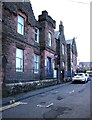
Blairgowrie Police Station
On Ericht Lane. Built in 1913 and Category C listed https://portal.historicenvironment.scot/designation/LB49424.
Image: © Richard Sutcliffe
Taken: 31 Oct 2023
0.08 miles