
IMAGES TAKEN NEAR TO
Lindsey Road, STAMFORD, PE9 4SH
Introduction
This page details the photographs taken nearby to Lindsey Road, PE9 4SH by members of the Geograph project.
The Geograph project started in 2005 with the aim of publishing, organising and preserving representative images for every square kilometre of Great Britain, Ireland and the Isle of Man.

There are currently over 7.5m images from over14,400 individuals and you can help contribute to the project by visiting https://www.geograph.org.uk
Image Map
Images are licensed for reuse under creativecommons.org/licenses/by-sa/2.0
Notes
- Clicking on the map will re-center to the selected point.
- The higher the marker number, the further away the image location is from the centre of the postcode.
Image Listing (70 Images Found)
Images are licensed for reuse under creativecommons.org/licenses/by-sa/2.0
Image
Details
Distance

2

Ye Olde Bertie Arms Bertie Lane
First built in 1681 with 18th century extension this stone built, thatched roof pub was part of the Uffington House Estate. The Bertie Arms was purchased privately in 1968 and is Grade II Listed. Typically needing rethatching every 25 to 30 years it was done in 1998 and again in 2021 at a cost ‘well in excess of £50,000’ taking advantage of the COVID-19 lockdown. Directory entries for Bertie Arms include, 1856 Thomas Cooper, 1861-1872 John Pogson (also saddler), 1885 Mrs Ellen Pogson (now listed as an inn), 1889 William Rollings, 1905 Joseph B Caucutt, 1913 Joseph Byatt and 1919 George Frisby.
Image: © Jo and Steve Turner
Taken: 23 Apr 2011
0.09 miles

4

Grassy open space at Uffington
A public footpath through open grassland at Uffington.
Image: © Ajay Tegala
Taken: 9 Apr 2009
0.14 miles

7
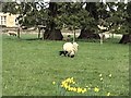
Springtime in Uffington
Sheep and lambs in a grassfield next to the church
Image: © Richard Humphrey
Taken: 17 Mar 2019
0.17 miles
8

The village green at Uffington
This rather novel float had clearly got something to do with the wedding of Prince William and Kate Middleton which had taken place the day before. Uffington Church can be seen through the trees to the left.
Image: © Marathon
Taken: 30 Apr 2011
0.18 miles
9

Ordnance Survey Cut Mark
This mark can be found on the wall of St Michael's Church, Uffington.
The recorded details give a height of 32.3576 metres above sea level.
For more details see : https://www.bench-marks.org.uk/bm77051
Image: © Peter Wood
Taken: 8 Oct 2021
0.18 miles
10

St Michael & All Angels, Uffington - Monument
Image: © John Salmon
Taken: 11 Jun 2011
0.19 miles