
IMAGES TAKEN NEAR TO
New Road, STAMFORD, PE9 4HL
Introduction
This page details the photographs taken nearby to New Road, PE9 4HL by members of the Geograph project.
The Geograph project started in 2005 with the aim of publishing, organising and preserving representative images for every square kilometre of Great Britain, Ireland and the Isle of Man.

There are currently over 7.5m images from over14,400 individuals and you can help contribute to the project by visiting https://www.geograph.org.uk
Image Map
Images are licensed for reuse under creativecommons.org/licenses/by-sa/2.0
Notes
- Clicking on the map will re-center to the selected point.
- The higher the marker number, the further away the image location is from the centre of the postcode.
Image Listing (133 Images Found)
Images are licensed for reuse under creativecommons.org/licenses/by-sa/2.0
Image
Details
Distance


4
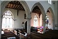
South arcade
Early English 13th century south arcade in St.John the Evangelist's church
Image: © Richard Croft
Taken: 28 Jul 2008
0.09 miles
5

Waterleaf capital
A variation on waterleaf on a 13th century respond capital in St.John the Evangelist's church
Image: © Richard Croft
Taken: 28 Jul 2008
0.10 miles
6

Farmland on the edge of Ryhall
Looking towards St. John the Evangelist church.
Image: © Mat Fascione
Taken: 8 Mar 2014
0.10 miles

8

St.John the Evangelist's tower
Interesting asymmetrical features on the 13th century Early English tower and broach spire, with a 15th century south porch.
Image: © Richard Croft
Taken: 28 Jul 2008
0.10 miles
9

St.John the Evangelist's nave
Looking west towards the tower arch
Image: © Richard Croft
Taken: 28 Jul 2008
0.10 miles
10

Ryhall
The centre of the village; the path straight forwards leads into the churchyard. The road to the left was a dead end on the 1940s map but now goes through a housing estate to the A6121. The church of St John Evangelist is largely 13C.
Image: © Humphrey Bolton
Taken: Unknown
0.10 miles