
IMAGES TAKEN NEAR TO
Bourne Road, STAMFORD, PE9 4EH
Introduction
This page details the photographs taken nearby to Bourne Road, PE9 4EH by members of the Geograph project.
The Geograph project started in 2005 with the aim of publishing, organising and preserving representative images for every square kilometre of Great Britain, Ireland and the Isle of Man.

There are currently over 7.5m images from over14,400 individuals and you can help contribute to the project by visiting https://www.geograph.org.uk
Image Map
Images are licensed for reuse under creativecommons.org/licenses/by-sa/2.0
Notes
- Clicking on the map will re-center to the selected point.
- The higher the marker number, the further away the image location is from the centre of the postcode.
Image Listing (11 Images Found)
Images are licensed for reuse under creativecommons.org/licenses/by-sa/2.0
Image
Details
Distance

2

A6121 Bourne Road
Passing a former school on the right. About as far as possible from housing, and certainly as far north as you can get in Rutland on that side of the road, right up against the Lincolnshire boundary. What was the story here?
Image: © Robin Webster
Taken: 2 May 2021
0.02 miles
3

A6121 towards Bourne
Approaching the Rutland-Lincolnshire boundary (Image) between Essendine and Carlby.
Image: © Jonathan Billinger
Taken: 29 Dec 2010
0.07 miles
4

Welcome to Lincolnshire
The new 'Lincoln Imp' signs are up around the second-largest county in England.
Image: © Jonathan Billinger
Taken: 29 Dec 2010
0.10 miles
5

A6121 Bourne Road
North from Essendine towards Bourne.
Image: © Robin Webster
Taken: 2 May 2021
0.15 miles
6

View toward Essendine
Hoar frost on the fields, looking from the former Bourne & Essendine railway bridge toward the new housing in Essendine.
Image: © Bob Harvey
Taken: 13 Dec 2012
0.16 miles
7
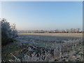
Hoar frost
Cutting and adjacent field in hoar frost. This is from the former bridge on the former Bourne and Essendine railway
Image: © Bob Harvey
Taken: 13 Dec 2012
0.16 miles
8

Road junction near Crownfield House
On the southern edge of the village of Carlby.
Image: © Mat Fascione
Taken: 8 Mar 2014
0.21 miles
9

Route of former railway near Carlby, Lincolnshire
Cutting of the Bourne and Essendine railway, unused since 1951
Image: © Richard Humphrey
Taken: 1 May 2015
0.21 miles
10

Frosty roadside
The post and rail fences were erected when the former brick bridge parapets were removed.
There was a humpacked bridge here - not much of a hump, to be honest- where the road crossed the former Bourne and Essendine railway. Around 50 years after the railway closed the bridge was declared unsafe - there had been earthquakes and flooding - and the whole thing was taken down and filled in. It had been rather an imposing structure, when seen (as hardly anyone did) from the abandoned railway cutting.
Image: © Bob Harvey
Taken: 13 Dec 2012
0.23 miles