
IMAGES TAKEN NEAR TO
Holmes Drive, STAMFORD, PE9 3YB
Introduction
This page details the photographs taken nearby to Holmes Drive, PE9 3YB by members of the Geograph project.
The Geograph project started in 2005 with the aim of publishing, organising and preserving representative images for every square kilometre of Great Britain, Ireland and the Isle of Man.

There are currently over 7.5m images from over14,400 individuals and you can help contribute to the project by visiting https://www.geograph.org.uk
Image Map
Images are licensed for reuse under creativecommons.org/licenses/by-sa/2.0
Notes
- Clicking on the map will re-center to the selected point.
- The higher the marker number, the further away the image location is from the centre of the postcode.
Image Listing (74 Images Found)
Images are licensed for reuse under creativecommons.org/licenses/by-sa/2.0
Image
Details
Distance
1
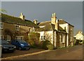
The Geeston Tap
These buildings are marked on earlier OS maps as a brewery, and represent a typical small village brewery. Now converted to residential accommodation.
Image: © Alan Murray-Rust
Taken: 7 Jan 2016
0.04 miles
2

23 and 27 Geeston
Cottages in the former hamlet of Geeston.
Image: © Alan Murray-Rust
Taken: 7 Jan 2016
0.05 miles
3

9 and 11 Geeston
17th century house (dated 1670 http://www.geograph.org.uk/photo/4791017 ), extended to the left in the 20th century and now forming two dwellings. coursed limestone rubble with ashlar dressings and Collyweston stone slate. Listed Grade II.
Image: © Alan Murray-Rust
Taken: 7 Jan 2016
0.06 miles
4

The railway at Ketton
Looking towards the site of Ketton and Collyweston Station. A trailing crossover can just be seen in the distance.
Image: © Jonathan Thacker
Taken: 28 Dec 2019
0.06 miles
5

Datestone on Thimble Cottage, Geeston
See http://www.geograph.org.uk/photo/4791021 for location.
Image: © Alan Murray-Rust
Taken: 7 Jan 2016
0.06 miles
6

Footbridge over the railway between Geeston and Ketton
Image: © Jonathan Thacker
Taken: 28 Dec 2019
0.07 miles
7

Nos 9 and 11 Geeston
House dating from 1670 now divided into 2 dwellings https://historicengland.org.uk/listing/the-list/list-entry/1073817
Image: © Jonathan Thacker
Taken: 28 Dec 2019
0.07 miles
8

Overlooking the Welland Valley
A house in Geeston. The Grange and Long Barn.
Image: © Bob Harvey
Taken: 19 Nov 2021
0.07 miles

10

Geeston to Ketton railway footbridge
This footbridge crosses the Oakham to Stamford railway line.
Image: © Graham Horn
Taken: 22 Apr 2007
0.07 miles