
IMAGES TAKEN NEAR TO
Hunts Lane, STAMFORD, PE9 3TG
Introduction
This page details the photographs taken nearby to Hunts Lane, PE9 3TG by members of the Geograph project.
The Geograph project started in 2005 with the aim of publishing, organising and preserving representative images for every square kilometre of Great Britain, Ireland and the Isle of Man.

There are currently over 7.5m images from over14,400 individuals and you can help contribute to the project by visiting https://www.geograph.org.uk
Image Map
Images are licensed for reuse under creativecommons.org/licenses/by-sa/2.0
Notes
- Clicking on the map will re-center to the selected point.
- The higher the marker number, the further away the image location is from the centre of the postcode.
Image Listing (112 Images Found)
Images are licensed for reuse under creativecommons.org/licenses/by-sa/2.0
Image
Details
Distance
1

Paddock alongside Hunts Lane
The local village magazine informs us that Hunts Lane was named after Samuel Hunt (1811-1892) a prominent local resident, residing at Ketton House and holding the post of High Sheriff of Rutland in 1860.
Image: © Alan Murray-Rust
Taken: 7 Jan 2016
0.04 miles
2

88, High Street, Ketton
Early 18th century in origin, but much rebuilt and extended in the 19th. Coursed squared stone with ashlar dressings and Collyweston stone slate roof. Listed Grade II. At one stage it was St Mary's Diocesan Home, a hostel for reforming young women.
Image: © Alan Murray-Rust
Taken: 7 Jan 2016
0.08 miles
3

78 and 76 High Street Ketton
The further house (76) dates from the 17th century, although heavily rebuilt in the 19th century, the period in which the nearer cottage was built. Both are Listed Grade II, No.78 for group value only.
Image: © Alan Murray-Rust
Taken: 7 Jan 2016
0.09 miles
4

92, High Street, Ketton
Late 18th century house, coursed limestone rubble with ashlar dressings and Collyweston stone slate roof. Listed Grade II.
Image: © Alan Murray-Rust
Taken: 7 Jan 2016
0.09 miles
5
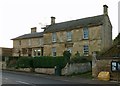
72 and 74 High Street, Ketton
Mid 19th century houses faced in ashlar with welsh slate roofs. No.72 (nearer) is dated 1851, No.74 is dated 1837. Both are Listed Grade II.
Image: © Alan Murray-Rust
Taken: 7 Jan 2016
0.10 miles
6

High Street, Ketton
The late afternoon sunlight highlights the cement works above the darkening village, as if to emphasise its importance within the local economy.
Image: © Alan Murray-Rust
Taken: 7 Jan 2016
0.10 miles
8

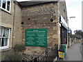
96 & 94 High Street, Ketton
Dating back in part to the 16th century, these are among the oldest buildings in the village. It is noticeable how much the road level has been raised since they were built. Listed Grade II.
Image: © Alan Murray-Rust
Taken: 28 Dec 2015
0.11 miles
9

55 High Street, Ketton
Early 19th century cottage in coursed limestone rubble with slate roof. Listed Grade II.
Image: © Alan Murray-Rust
Taken: 7 Jan 2016
0.11 miles
10

High Street, Ketton
The building on the far left is part of a housing estate which was finished around the end of 2016
Image: © David Howard
Taken: 28 Mar 2017
0.11 miles