
IMAGES TAKEN NEAR TO
The Crescent, STAMFORD, PE9 3SY
Introduction
This page details the photographs taken nearby to The Crescent, PE9 3SY by members of the Geograph project.
The Geograph project started in 2005 with the aim of publishing, organising and preserving representative images for every square kilometre of Great Britain, Ireland and the Isle of Man.

There are currently over 7.5m images from over14,400 individuals and you can help contribute to the project by visiting https://www.geograph.org.uk
Image Map
Images are licensed for reuse under creativecommons.org/licenses/by-sa/2.0
Notes
- Clicking on the map will re-center to the selected point.
- The higher the marker number, the further away the image location is from the centre of the postcode.
Image Listing (33 Images Found)
Images are licensed for reuse under creativecommons.org/licenses/by-sa/2.0
Image
Details
Distance
1

Boarded up Bungalow
One of a row of Bungalows on the edge of the Ketton Cement site which are boarded up.
I rather think they were built with cement boards and blocks from the original Ketton Cement company, and they are similar to ones near Essendine. A sort of 1930s system construction.
Image: © Bob Harvey
Taken: 10 Oct 2018
0.02 miles
2

High street with Phone Box and Trees
Image: © Bob Harvey
Taken: 10 Oct 2018
0.02 miles
3

"The Crescent"
The row of prefab bungalows along the main road are known as "The Crescent"
Image: © Bob Harvey
Taken: 10 Oct 2018
0.02 miles

5

The Crescent, High Street, Ketton
Clearly built to a common specification, and using concrete block or reconstituted stone, they may well have been built as workers' houses by the neighbouring cement works. There is no indication as to why they are now all unoccupied, as they appear reasonably sound.
Image: © Alan Murray-Rust
Taken: 7 Jan 2016
0.03 miles
6

Former telephone box, now a Defibrillator box
The phone box in Image has been converted to house a defibrillator.
The box is a grade II listed structure. See https://historicengland.org.uk/listing/the-list/list-entry/1394065
There is another defibrillator in the village, see Image
Image: © Bob Harvey
Taken: 10 Oct 2018
0.03 miles
7

Former Ketton Grange
The Grange has at some stage been split into three separate dwellings, and interestingly each dwelling has a separate English Heritage listing, Grade II. This end is The Gable House, comprising the 19th century western cross wing of the Grange. The little stone roofed buildings in the foreground are not included in the listing.
Image: © Alan Murray-Rust
Taken: 7 Jan 2016
0.03 miles
8

Disused bungalows
More of the row of boarded up homes known as "The Crescent"
Image: © Bob Harvey
Taken: 10 Oct 2018
0.04 miles
9
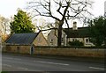
Former Ketton Grange
The Grange has at some stage been split into three separate dwellings, and interestingly each dwelling has a separate English Heritage listing, Grade II. This end is Grange House, an early 20th century extension to the original Grange, in matching style. Listed Grade II for group value. The part of the building to the right, behind the holly tree, is the original Ketton Grange, now named Ketton House, which dates back to the 17th century, but with substantial 19th century alterations. Listed Grade II.
Image: © Alan Murray-Rust
Taken: 7 Jan 2016
0.04 miles
10

Wall and Gate
The wall at Ketton Grange
Image: © Bob Harvey
Taken: 10 Oct 2018
0.04 miles