
IMAGES TAKEN NEAR TO
Main Road, STAMFORD, PE9 3PQ
Introduction
This page details the photographs taken nearby to Main Road, PE9 3PQ by members of the Geograph project.
The Geograph project started in 2005 with the aim of publishing, organising and preserving representative images for every square kilometre of Great Britain, Ireland and the Isle of Man.

There are currently over 7.5m images from over14,400 individuals and you can help contribute to the project by visiting https://www.geograph.org.uk
Image Map
Images are licensed for reuse under creativecommons.org/licenses/by-sa/2.0
Notes
- Clicking on the map will re-center to the selected point.
- The higher the marker number, the further away the image location is from the centre of the postcode.
Image Listing (53 Images Found)
Images are licensed for reuse under creativecommons.org/licenses/by-sa/2.0
Image
Details
Distance

2

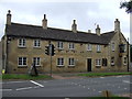
Collyweston House
Built 1838, coursed rubble limestone with ashlar detailing and Collyweston stone slate roof.
Image: © Alan Murray-Rust
Taken: 28 Dec 2015
0.11 miles

5

Church of St Andrew, Collyweston
The South Chapel. An unusual addition, complete with separate west door, it dates from the late 15th century and may well have been built by Margaret Beaufort, Countess of Richmond, who lived at Collyweston Palace.
Image: © Alan Murray-Rust
Taken: 28 Dec 2015
0.13 miles
7

Church of St Andrew, Collyweston
A difficult church to do photographic justice to as the small churchyard is well planted with yew trees.
The church dates back to the 11th century although there is little visible evidence of early work on the exterior. The tower is Perpendicular, of the 15th century. The Church is Listed Grade II*.
The group of chest tombs just visible between the tower and porch are separately Listed Grade II.
There is a bench mark http://www.geograph.org.uk/photo/4779334 at the base of the left hand buttress of the tower.
Image: © Alan Murray-Rust
Taken: 28 Dec 2015
0.13 miles
8

Collyweston War Memorial
In the churchyard, and heavily surrounded by yew trees. Unveiled in 1920 to commemorate the fallen of the first World War, and with later inscription for the Second. Designed by local architect H.F.Traylen, Listed Grade II in 2015.
Image: © Alan Murray-Rust
Taken: 28 Dec 2015
0.13 miles
9
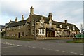
The Collyweston Slater
A large pub alongside the main A43 through the village.
The English Heritage Pastscape entry http://pastscape.org.uk/hob.aspx?hob_id=544020 suggests that the buildings were converted from houses to a pub in the 1970s, but in practice old OS maps show at least the far right hand end marked as the Slaters Arms at the end of the 19th century. The 1970s conversion almost certainly involved the inclusion of the house on the corner. This is dated 1856, while the rest of the right hand range dates back to the 17th century.
Image: © Alan Murray-Rust
Taken: 28 Dec 2015
0.13 miles
10

Bench mark on St Andrew's Church
See http://www.geograph.org.uk/photo/4779342 for location.
Image: © Alan Murray-Rust
Taken: 28 Dec 2015
0.13 miles