
IMAGES TAKEN NEAR TO
Unity Houses, STAMFORD, PE9 3HJ
Introduction
This page details the photographs taken nearby to Unity Houses, PE9 3HJ by members of the Geograph project.
The Geograph project started in 2005 with the aim of publishing, organising and preserving representative images for every square kilometre of Great Britain, Ireland and the Isle of Man.

There are currently over 7.5m images from over14,400 individuals and you can help contribute to the project by visiting https://www.geograph.org.uk
Image Map
Images are licensed for reuse under creativecommons.org/licenses/by-sa/2.0
Notes
- Clicking on the map will re-center to the selected point.
- The higher the marker number, the further away the image location is from the centre of the postcode.
Image Listing (15 Images Found)
Images are licensed for reuse under creativecommons.org/licenses/by-sa/2.0
Image
Details
Distance
1
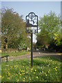
Pilsgate village sign
Situated on a small green next to the B1443, the attractive sign includes a windmill to signify the windmill to the south of the village at Windmill Farm - see https://www.geograph.org.uk/photo/2444529
Image: © Marathon
Taken: 30 Apr 2011
0.03 miles

3
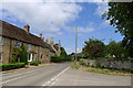
The B1443 through Pilsgate
Grade II listed buildings on the left; dating from the 18th and (with tall chimneys) 17th century https://historicengland.org.uk/listing/the-list/list-entry/1162250
Image: © Tim Heaton
Taken: 27 May 2020
0.05 miles
4

Pilsgate
Stamford Road through the small hamlet of Pilsgate
Image: © Richard Croft
Taken: 17 Jul 2006
0.06 miles
5

Websters Farmhouse, Pilsgate
18th century house of coursed stone rubble with a steeply pitched roof of Collyweston stone slates. Beyond is the slightly older Pilsgate House. Both are Listed Grade II.
Image: © Alan Murray-Rust
Taken: 28 Dec 2012
0.07 miles
7

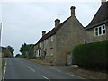
North edge of Pilsgate
The small scarp is the outcrop of the Lower Lincolnshire Limestone.
Image: © Dylan Moore
Taken: 26 Jun 2016
0.07 miles
8
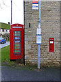
Triple communications at Pilsgate
In historical order, the postbox (VR wall box - see http://www.geograph.org.uk/photo/204138), K6 telephone kiosk and bus stop. Although the bus stop plate is in Stagecoach colours, the service (between Stamford and Peterborough) is provided by the family firm Delaine of Bourne.
Image: © Alan Murray-Rust
Taken: 28 Dec 2012
0.08 miles
9
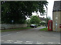
Pudding Bag Lane, Pilsgate
Off National Cycle Route 63.
Image: © JThomas
Taken: 31 May 2014
0.08 miles
10

Entering Pilsgate
Heading south east on the B1443.
National Cycle Route 63.
Image: © JThomas
Taken: 31 May 2014
0.08 miles