
IMAGES TAKEN NEAR TO
Main Street, STAMFORD, PE9 3BX
Introduction
This page details the photographs taken nearby to Main Street, PE9 3BX by members of the Geograph project.
The Geograph project started in 2005 with the aim of publishing, organising and preserving representative images for every square kilometre of Great Britain, Ireland and the Isle of Man.

There are currently over 7.5m images from over14,400 individuals and you can help contribute to the project by visiting https://www.geograph.org.uk
Image Map
Images are licensed for reuse under creativecommons.org/licenses/by-sa/2.0
Notes
- Clicking on the map will re-center to the selected point.
- The higher the marker number, the further away the image location is from the centre of the postcode.
Image Listing (19 Images Found)
Images are licensed for reuse under creativecommons.org/licenses/by-sa/2.0
Image
Details
Distance
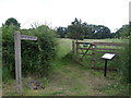
3

Blocks of Barnack Rag Limestone, Main Street, Southorpe
Image: © Tim Heaton
Taken: 6 Jul 2021
0.09 miles
4

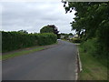
Main Street, Southorpe
The road that runs through Southorpe in Cambridgeshire.
Image: © Ajay Tegala
Taken: 8 Apr 2011
0.12 miles
5

Field by Main Street, Southorpe
The field was divided in two, with the large sheep by the road and one horse on the other side. It's not usual to have a sheep on their own.
Image: © David Howard
Taken: 6 Apr 2019
0.12 miles


8
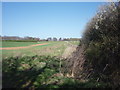
Hereward Way
A stretch of Hereward Way running slightly uphill near Southorpe.
Image: © Ajay Tegala
Taken: 8 Apr 2011
0.22 miles
9
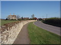
Stud Farm, Main Street, Southorpe
Looking along Main Street towards Stud Farm, taken from outside Grange Farm. Note the limestone wall, characteristic of the area.
Image: © Ajay Tegala
Taken: 8 Apr 2011
0.22 miles
10

Gate on the Hereward Way
The bridleway follows the route of the Roman Ermine Street.
Image: © Jonathan Thacker
Taken: 28 Dec 2019
0.23 miles