
IMAGES TAKEN NEAR TO
South View Business Park, Tinwell Road, STAMFORD, PE9 2JL
Introduction
This page details the photographs taken nearby to South View Business Park, Tinwell Road, PE9 2JL by members of the Geograph project.
The Geograph project started in 2005 with the aim of publishing, organising and preserving representative images for every square kilometre of Great Britain, Ireland and the Isle of Man.

There are currently over 7.5m images from over14,400 individuals and you can help contribute to the project by visiting https://www.geograph.org.uk
Image Map
Images are licensed for reuse under creativecommons.org/licenses/by-sa/2.0
Notes
- Clicking on the map will re-center to the selected point.
- The higher the marker number, the further away the image location is from the centre of the postcode.
Image Listing (39 Images Found)
Images are licensed for reuse under creativecommons.org/licenses/by-sa/2.0
Image
Details
Distance

2

Tinwell pumping station
Water from the River Welland is pumped from here into the Rutland Water storage reservoir http://www.rutlandhistory.org/HRW/chapter-017
Image: © Tim Heaton
Taken: 13 Dec 2009
0.12 miles
3

Tinwell pumping station
Built to extract water from, or return it to, the Welland for Empingham Reservoir, otherwise known as Rutland Water.
See http://www.rutlandhistory.org/HRW/chapter-017 for a lot of details about the reservoir and https://assets.publishing.service.gov.uk/government/uploads/system/uploads/attachment_data/file/289703/Welland_Valley_Partnership_River_Improvment_Plan_15_02_13_FINAL__2__f0d67b.pdf for a great deal about the river
Image: © Bob Harvey
Taken: 24 Jul 2022
0.12 miles
4

A1 approaching A6121 turning
Starting to head uphill after crossing the River Welland.
Image: © Robin Webster
Taken: 7 Oct 2011
0.13 miles
5

River Welland
Looking downstream from the A1 bridge. Normally I would take this view from the deck of the bridge, but that is just too dangerous to attempt on the side of the A1.
Image: © Bob Harvey
Taken: 24 Jul 2022
0.15 miles
6
Over the river
Crossing the River Welland on the bridge seen in Image This is the southbound carriageway of the A1 road.
Image: © Bob Harvey
Taken: 1 Aug 2022
0.15 miles
7

Footpath and Bridge
This is the track that eventually passes under the A1 with the River Welland. It is a historic bridleway, and marks the parish boundaries in places
Image: © Bob Harvey
Taken: 24 Jul 2022
0.16 miles
8

Arch over the Welland
The A1 bridge over the river Welland near Tinwell
Image: © Bob Harvey
Taken: 24 Jul 2022
0.16 miles
9
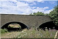
Two arches
The twin arches of the Welland Bridge on the A1. The dry side is not just a farm access, but is a relief channel for those years when the Welland steps outside its bounds.
Image: © Bob Harvey
Taken: 24 Jul 2022
0.16 miles
10
A1 over the Welland
My passenger managed to get a useful view of the roadway on the A1 bridge over the Welland. The parapet walls are those seen in Image
Image: © Arthur Devere Parmenter-Harvey
Taken: 31 Jul 2022
0.16 miles