
IMAGES TAKEN NEAR TO
Uffington Road, STAMFORD, PE9 2HA
Introduction
This page details the photographs taken nearby to Uffington Road, PE9 2HA by members of the Geograph project.
The Geograph project started in 2005 with the aim of publishing, organising and preserving representative images for every square kilometre of Great Britain, Ireland and the Isle of Man.

There are currently over 7.5m images from over14,400 individuals and you can help contribute to the project by visiting https://www.geograph.org.uk
Image Map
Images are licensed for reuse under creativecommons.org/licenses/by-sa/2.0
Notes
- Clicking on the map will re-center to the selected point.
- The higher the marker number, the further away the image location is from the centre of the postcode.
Image Listing (79 Images Found)
Images are licensed for reuse under creativecommons.org/licenses/by-sa/2.0
Image
Details
Distance
1

Derelict Potato Depot
Once the headquarters, grading, and distribution hub for Gilman Potatoes, this site is looking for a purpose.
Image: © Bob Harvey
Taken: 26 Sep 2018
0.02 miles
2

A posh shop
This is Aldi Stamford, a recent development on a site which was once a potato merchant's.
Image: © Bob Harvey
Taken: 9 Jan 2022
0.05 miles
3

Demolition site on south side of Uffington Road
Image: © Roger Templeman
Taken: 6 Apr 2016
0.06 miles
4

Aldi Stamford
Much more restrained, and rather more upmarket than the adjacent Image This has also been the subject of the Stamford planning system, with its emphasis on stone.
Image: © Bob Harvey
Taken: 9 Jan 2022
0.06 miles
5

Just leave it there
Once the back gate to the Blackstones Factory, this is now a convenient place to dump cars, particularly the VW garage across the road that has no sort of place to park for visitors.
Image: © Bob Harvey
Taken: 22 Feb 2020
0.07 miles
6
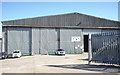
Central Wool Growers
A farming service company of some antiquity, which had expanded into retail and the horse trade, but since divested those interests across the Midlands to Mole Valley Farmers. It still continues in its more traditional role of wool grading and wholesaling. CWG moved out of this premises when Mole Valley used it as a wholesale distribution depot, but retained the freehold, moving back in when Mole Valley changed their arrangments.
Image: © Bob Harvey
Taken: 26 Sep 2018
0.07 miles
7

Car dealership and bridge over dismantled railway, Uppingham Road
There is an OS benchmark Image on the far pier of the bridge
Image: © Roger Templeman
Taken: 6 Apr 2016
0.07 miles
8

Mole store
Once known as "Mole Valley Farmers", and now "Mole Country Store" this is the pole sign for the shop.
Image: © Bob Harvey
Taken: 9 Jan 2022
0.08 miles
9

Benchmark on Uffington Road bridge
Ordnance Survey cut mark benchmark described on the Bench Mark Database at http://www.bench-marks.org.uk/bm74951
Image: © Roger Templeman
Taken: 6 Apr 2016
0.08 miles
10

Building site
Decades after the Blackstone factory closed this site has finally gone for housebuilding. None of the plans for Industry or bypasses or playing fields or wildlife sanctuaries that have been proposed, propounded, or hinted at have come to pass and the inevitable is happening. There won't be a high-tech industry park here after all.
Image: © Bob Harvey
Taken: 22 Jan 2023
0.08 miles