
IMAGES TAKEN NEAR TO
Tenter Court, Wharf Road, STAMFORD, PE9 2EZ
Introduction
This page details the photographs taken nearby to Tenter Court, Wharf Road, PE9 2EZ by members of the Geograph project.
The Geograph project started in 2005 with the aim of publishing, organising and preserving representative images for every square kilometre of Great Britain, Ireland and the Isle of Man.

There are currently over 7.5m images from over14,400 individuals and you can help contribute to the project by visiting https://www.geograph.org.uk
Image Map
Images are licensed for reuse under creativecommons.org/licenses/by-sa/2.0
Notes
- Clicking on the map will re-center to the selected point.
- The higher the marker number, the further away the image location is from the centre of the postcode.
Image Listing (2165 Images Found)
Images are licensed for reuse under creativecommons.org/licenses/by-sa/2.0
Image
Details
Distance
1

Stamford: reflections in the Welland
A view towards St Mary's Church and the town centre from Water Street. The sun was about to break through on what was to prove a bright winter day.
Image: © John Sutton
Taken: 7 Feb 2017
0.03 miles
2

Spring-time in Stamford: weeping willows and Lincolnshire limestone
Looking across the River Welland from the Sensory Garden (which lies south of the river on the St Martin's side). There is little in the picture other than three typical (and endearing) Stamford elements - river, willows, and limestone. The limestone in this instance forms part of a fairly recent residential development - one which has done no harm at all to the view along this stretch of river.
Image: © Stefan Czapski
Taken: 5 Apr 2008
0.03 miles
3

Houses on Wharf Road
There is an OS benchmark Image on the near house left of its black downpipe
Image: © Roger Templeman
Taken: 21 May 2015
0.03 miles
4

River Welland, Stamford
Dusk on the river at Stamford where a rainbow, following an evening of sunshine and showers, is reflected in the water.
Image: © Stephen McKay
Taken: 24 Jun 2016
0.03 miles
6

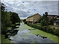
Benchmark on #2 Wharf Road
Ordnance Survey cut mark benchmark described on the Bench Mark Database at http://www.bench-marks.org.uk/bm67219
Image: © Roger Templeman
Taken: 21 May 2015
0.04 miles

8

View downstream along the Welland, from the Town Bridge, Stamford
Looking downstream from the bridge which carried the old Great North Road across the Welland. On the left, the old stone building is said to be a warehouse dating from the 17th century - part now houses a bar. On the right bank, recent residential development along Water Street, then trees in the 'Sensory Garden'. This is early April, and only the weeping willows are really green. In the distance is Albert Bridge, a little footbridge joining Water Street with Albert Road. A little nearer, on the left bank, recent housing built in local stone and unpretentious style, which (to my mind) fits in well in this 'sensitive' position.
Image: © Stefan Czapski
Taken: 2 Apr 2008
0.04 miles
9
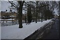
The Welland, Frozen
Between Albert and Town bridges in Stamford, the river was frozen hard after a week of "the beast from the east"
Image: © Bob Harvey
Taken: 2 Mar 2018
0.04 miles
10

River Welland from The Bridge, Stamford
Image: © David Martin
Taken: 26 Jun 2022
0.04 miles