
IMAGES TAKEN NEAR TO
Blackfriars Street, STAMFORD, PE9 2BW
Introduction
This page details the photographs taken nearby to Blackfriars Street, PE9 2BW by members of the Geograph project.
The Geograph project started in 2005 with the aim of publishing, organising and preserving representative images for every square kilometre of Great Britain, Ireland and the Isle of Man.

There are currently over 7.5m images from over14,400 individuals and you can help contribute to the project by visiting https://www.geograph.org.uk
Image Map
Images are licensed for reuse under creativecommons.org/licenses/by-sa/2.0
Notes
- Clicking on the map will re-center to the selected point.
- The higher the marker number, the further away the image location is from the centre of the postcode.
Image Listing (2003 Images Found)
Images are licensed for reuse under creativecommons.org/licenses/by-sa/2.0
Image
Details
Distance
1

Festive doors, festive windows
Georgian houses decorated for Christmas. These charming houses have the distinction of being just about the only older buildings round here not included as listed buildings.
Image: © Bob Harvey
Taken: 21 Dec 2015
0.01 miles
2

Danegeld Place
Some of the modern housing in Gas Lane. I am not sure I would name anything after The Danegeld, which is surely a badge of shame.
Image: © Bob Harvey
Taken: 21 Dec 2015
0.01 miles
3
![Stamford houses [175]](https://s0.geograph.org.uk/geophotos/07/15/38/7153860_38865c33_120x120.jpg)
Stamford houses [175]
Numbers 10, 11 and 12 St George's Square are an early 19th century terrace of three houses in red brick under a stone slate roof. Listed, grade II, with details at: https://historicengland.org.uk/listing/the-list/list-entry/1168748
Stamford is a market town on the southern border of Lincolnshire, located at the lowest point that the River Welland could be forded. It is some 11 miles northwest of Peterborough and about 27 miles east of Leicester, and is set on Roman Ermine Street and the Great North Road. The picturesque town is constructed almost entirely of limestone, much of the town centre was built in the 17th and 18th centuries in Jacobean or Georgian style. Tourism is an important element of Stamford’s economy.
Image: © Michael Dibb
Taken: 30 Sep 2021
0.02 miles
4
![Stamford buildings [121]](https://s1.geograph.org.uk/geophotos/07/15/38/7153861_a72405f8_120x120.jpg)
Stamford buildings [121]
This outbuilding to number 12 St George's Square is now used as a garage. Built in the early 19th century of coursed rubble stone under a stone slate roof. Listed, for group value, grade II, with details at: https://historicengland.org.uk/listing/the-list/list-entry/1062219
Stamford is a market town on the southern border of Lincolnshire, located at the lowest point that the River Welland could be forded. It is some 11 miles northwest of Peterborough and about 27 miles east of Leicester, and is set on Roman Ermine Street and the Great North Road. The picturesque town is constructed almost entirely of limestone, much of the town centre was built in the 17th and 18th centuries in Jacobean or Georgian style. Tourism is an important element of Stamford’s economy.
Image: © Michael Dibb
Taken: 30 Sep 2021
0.02 miles

6

13 St George's Square, Stamford
Former coachhouse and stables with hayloft over attached to no.12. Listed Grade II as 'outbuilding to no.12'. See http://www.geograph.org.uk/photo/6393641 for the side facing St George's Square.
Image: © Alan Murray-Rust
Taken: 14 Feb 2020
0.02 miles
7

5 Wharf Road, Stamford
Early 19th century cottage incorporating the remains of one of the bastions of the former medieval town walls. Listed Grade II.
Image: © Alan Murray-Rust
Taken: 14 Feb 2020
0.02 miles
8
![Stamford buildings [70]](https://s1.geograph.org.uk/geophotos/07/14/75/7147557_ac92cbe1_120x120.jpg)
Stamford buildings [70]
At the junction with Gas Lane, number 5 Wharf Road is built on the site of a former bastion of the town wall. Built in the early 19th century of coursed rubble stone under a Welsh slate roof. Listed, grade II, with details at: https://historicengland.org.uk/listing/the-list/list-entry/1062899
Stamford is a market town on the southern border of Lincolnshire, located at the lowest point that the River Welland could be forded. It is some 11 miles northwest of Peterborough and about 27 miles east of Leicester, and is set on Roman Ermine Street and the Great North Road. The picturesque town is constructed almost entirely of limestone, much of the town centre was built in the 17th and 18th centuries in Jacobean or Georgian style. Tourism is an important element of Stamford’s economy.
Image: © Michael Dibb
Taken: 30 Sep 2021
0.02 miles
9

Stamford: up Blackfriars Street
The day began gloomily, as shown here at about 10.45, but the clouds soon parted and most of the rest of the day was sunny. The spire of St Mary's Church shows above the roofs in the centre.
Image: © John Sutton
Taken: 7 Feb 2017
0.02 miles
10
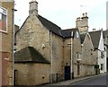
14 & 15 St George's Square, Stamford
Originally a medieval manor house, with much surviving masonry although there has been considerable change over the centuries, with major rebuilding in the 18th century. Listed Grade II*.
The Stamford volume of the Royal Commission on the Historical Monuments of England, 1977 describes it as follows:
"This house is said to have been the house of David Cyssell who died in 1536. It is said to have been demolished in 1720, but actually much of the old structure was retained but was drastically remodelled. It is built around an open courtyard. The main range is on the south and probably dates to the early 16th century. It had east and west cross wings which have been extended towards the street, on the east by the addition of a lower range added against the gable and on the west by the replacement of the wing with a longer one in the early 17th century. There are a number of early 17th century windows, some blocked, including a small projecting window on the north gable of the east wing which dates to around 1600. The interior has been much altered and the original room arrangement can no longer be detected. The east wing retains a massive fireplace with a reset stone bracket of around 1500. The south wing has various reset early 16th century ceiling beams. The staircase is early 18th century, and some rooms have early 19th century details."
Image: © Alan Murray-Rust
Taken: 14 Feb 2020
0.02 miles