
IMAGES TAKEN NEAR TO
Wansford Road, PETERBOROUGH, PE8 6ZE
Introduction
This page details the photographs taken nearby to Wansford Road, PE8 6ZE by members of the Geograph project.
The Geograph project started in 2005 with the aim of publishing, organising and preserving representative images for every square kilometre of Great Britain, Ireland and the Isle of Man.

There are currently over 7.5m images from over14,400 individuals and you can help contribute to the project by visiting https://www.geograph.org.uk
Image Map
Images are licensed for reuse under creativecommons.org/licenses/by-sa/2.0
Notes
- Clicking on the map will re-center to the selected point.
- The higher the marker number, the further away the image location is from the centre of the postcode.
Image Listing (19 Images Found)
Images are licensed for reuse under creativecommons.org/licenses/by-sa/2.0
Image
Details
Distance


3

Huskisson's Lodge
The farm is named on the map, but all these buildings appeared disused in 2008. In fact they were roped off with "dangerous structure" notices. According to the Explorer map there should be a stream running through this view, but it was dry even in December, so presumably it is only seasonal in times of heavy rain, i.e. a bourne.
Image: © Stephen Craven
Taken: 27 Dec 2008
0.02 miles


7
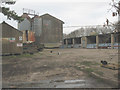
The cats take over the pig farm
From the notices visible, this was once a pig farm, but there was no sight, sound or smell of the animals so presumably it has closed. There were at least four feral cats prowling the site!
Image: © Stephen Craven
Taken: 27 Dec 2008
0.13 miles
8

Tracks on a valley side
The low light on a December afternoon makes these animal paths look much deeper than they really are.
Image: © Christine Johnstone
Taken: 28 Dec 2011
0.16 miles
9

Roman Road descending towards King's Cliffe
Image: © Mat Fascione
Taken: 3 Apr 2016
0.17 miles
10

Limestone scenery near King's Cliffe
There has been historic working of the Jurassic limestone around King's Cliffe, some of it in mines rather than open quarries, and the humps in this photo are probably evidence of it. In 2006 Peterborough Council rejected an application for permission to open a large open-cast quarry in the area.
Image: © Stephen Craven
Taken: 27 Dec 2008
0.17 miles