
IMAGES TAKEN NEAR TO
Howards Meadow, PETERBOROUGH, PE8 6YJ
Introduction
This page details the photographs taken nearby to Howards Meadow, PE8 6YJ by members of the Geograph project.
The Geograph project started in 2005 with the aim of publishing, organising and preserving representative images for every square kilometre of Great Britain, Ireland and the Isle of Man.

There are currently over 7.5m images from over14,400 individuals and you can help contribute to the project by visiting https://www.geograph.org.uk
Image Map
Images are licensed for reuse under creativecommons.org/licenses/by-sa/2.0
Notes
- Clicking on the map will re-center to the selected point.
- The higher the marker number, the further away the image location is from the centre of the postcode.
Image Listing (72 Images Found)
Images are licensed for reuse under creativecommons.org/licenses/by-sa/2.0
Image
Details
Distance
1

62 Park Street, King's Cliffe
Seventeenth century house https://historicengland.org.uk/listing/the-list/list-entry/1066566
Image: © Jonathan Thacker
Taken: 2 Aug 2019
0.05 miles

3

Rockbourne, Park Street, King's Cliffe
Designed by J.B. Corby 1900.
Image: © Jonathan Thacker
Taken: 2 Aug 2019
0.06 miles
4

Old circular AA Sign on Park Street, King's Cliffe
Old AA Sign on the wall of The Old Red Lion, a former PH, on the north side of Park Street in King's Cliffe, 12 miles west of Peterborough. King's Cliffe parish.
This is the circular, village name on black band, no Motor Union symbol or name type, dating from 1923, showing distances Kettering 16 Stamford 7 London 87½.
There were five series of AA signs, mostly dating from 1923 and made by Francis & Co / Franco in Deptford, London. The village name and distance to London were displayed.
See also https://www.geograph.org.uk/photo/255960 , https://www.flickr.com/photos/andrewfarren/5826249584 and https://www.flickr.com/photos/andrewfarren/5825691859.
Milestone Society National ID: NR-KINGS
Image: © Milestone Society
Taken: Unknown
0.06 miles
5

King's Cliffe: houses on Park Street
The buildings in this village are of a light-coloured stone reminiscent of the Cotswolds, which gave an attractive appearance even on a cloudy December day.
Image: © Stephen Craven
Taken: 27 Dec 2008
0.07 miles
6

Sundial Cottage and The Wheatsheaf
Two eighteenth century houses. The Wheatsheaf (on the left) is a former public house. https://historicengland.org.uk/listing/the-list/list-entry/1066561
Image: © Jonathan Thacker
Taken: 2 Aug 2019
0.08 miles
7

Library van on Park Street
Northamptonshire Libraries service visiting Kingscliffe
Image: © Michael Trolove
Taken: 18 Mar 2009
0.10 miles
8
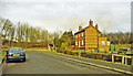
Site of King's Cliffe station, 2000
View northward towards the line of the ex-LNWR Market Harborough - Seaton (to left) - Peterborough East (to right) line. The station, which had been to the left, and the line were closed to passengers 6/6/66, to goods 3/6/68. [Precise localization open to correction?]
Image: © Ben Brooksbank
Taken: 19 Jan 2000
0.14 miles
9

Boscobel and Village Store, King's Cliffe
Boscobel is a seventeenth century house. https://historicengland.org.uk/listing/the-list/list-entry/1225662
Image: © Jonathan Thacker
Taken: 2 Aug 2019
0.15 miles
10

Pleasant View, Park Street, King's Cliffe
Former John Thorpe Almshouses dating from 1668 https://historicengland.org.uk/listing/the-list/list-entry/1357133
Image: © Jonathan Thacker
Taken: 2 Aug 2019
0.15 miles