
IMAGES TAKEN NEAR TO
Park Close, PETERBOROUGH, PE8 6XW
Introduction
This page details the photographs taken nearby to Park Close, PE8 6XW by members of the Geograph project.
The Geograph project started in 2005 with the aim of publishing, organising and preserving representative images for every square kilometre of Great Britain, Ireland and the Isle of Man.

There are currently over 7.5m images from over14,400 individuals and you can help contribute to the project by visiting https://www.geograph.org.uk
Image Map
Images are licensed for reuse under creativecommons.org/licenses/by-sa/2.0
Notes
- Clicking on the map will re-center to the selected point.
- The higher the marker number, the further away the image location is from the centre of the postcode.
Image Listing (24 Images Found)
Images are licensed for reuse under creativecommons.org/licenses/by-sa/2.0
Image
Details
Distance
1
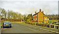
Site of King's Cliffe station, 2000
View northward towards the line of the ex-LNWR Market Harborough - Seaton (to left) - Peterborough East (to right) line. The station, which had been to the left, and the line were closed to passengers 6/6/66, to goods 3/6/68. [Precise localization open to correction?]
Image: © Ben Brooksbank
Taken: 19 Jan 2000
0.06 miles
2

Railway bridge across Park Street, King's Cliffe
Image: © Mat Fascione
Taken: 3 Apr 2016
0.08 miles
3

Beware of the hidden bend
A view of the former LNWR railway bridge Image from the other side. There is a sharp bend beyond it, not immediately obvious to drivers from this side, so there is a series of warning signs on the approach: "oncoming vehicles in centre of road", "sharp bend" pictogram, and 30mph speed limit.
Image: © Stephen Craven
Taken: 27 Dec 2008
0.09 miles

5

Park Street leaving King's Cliffe
Passing beneath the disused Seaton to Wansford railway line.
Image: © Tim Heaton
Taken: 12 Nov 2020
0.10 miles
6

Railway bridge, King's Cliffe
Carried the former London and North Western Railway line from Rugby to Peterborough.
Image: © Jonathan Thacker
Taken: 2 Aug 2019
0.10 miles
7

Rockbourne, Park Street, King's Cliffe
Designed by J.B. Corby 1900.
Image: © Jonathan Thacker
Taken: 2 Aug 2019
0.10 miles
8

Corrugated iron roof
The trees crossing the picture from the left mark the line of the former railway line.
Image: © Jonathan Thacker
Taken: 2 Aug 2019
0.11 miles
9

62 Park Street, King's Cliffe
Seventeenth century house https://historicengland.org.uk/listing/the-list/list-entry/1066566
Image: © Jonathan Thacker
Taken: 2 Aug 2019
0.11 miles
10

Railway Bridge at Kings Cliffe
The bridge lies just to the east of the site of Kings Cliffe station. The original line was closed long ago but a few miles to the east lives on in the form of the Nene Valley Steam Railway.
Image: © Mike Bardill
Taken: 7 Oct 2006
0.11 miles