
IMAGES TAKEN NEAR TO
The Drove, PETERBOROUGH, PE8 6QP
Introduction
This page details the photographs taken nearby to The Drove, PE8 6QP by members of the Geograph project.
The Geograph project started in 2005 with the aim of publishing, organising and preserving representative images for every square kilometre of Great Britain, Ireland and the Isle of Man.

There are currently over 7.5m images from over14,400 individuals and you can help contribute to the project by visiting https://www.geograph.org.uk
Image Map
Images are licensed for reuse under creativecommons.org/licenses/by-sa/2.0
Notes
- Clicking on the map will re-center to the selected point.
- The higher the marker number, the further away the image location is from the centre of the postcode.
Image Listing (75 Images Found)
Images are licensed for reuse under creativecommons.org/licenses/by-sa/2.0
Image
Details
Distance
1

Fenn Close, Nassington
This shows the recent northern extension of Fenn Close. Most of the dwellings seen here have yet to be occupied.
Image: © David Kemp
Taken: 26 Jun 2022
0.05 miles
2
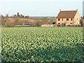
Large crop field, north of Apethorpe road
The new house is the last one in Fenn Close, Nassington.
Image: © Christine Johnstone
Taken: 28 Dec 2011
0.09 miles
3

39 metre spot height, Apethorpe Road
With new houses on the edge of Nassington in the distance.
Image: © Christine Johnstone
Taken: 28 Dec 2011
0.10 miles
4

Byway Ford at Nassington
This is the second of the two fords found at Nassington.
Image: © John Walton
Taken: 1 Jul 2012
0.13 miles
5

Ford at Nassington
Probably deeper than usual for two reasons: recent heavy rain and partly blocked culvert on the right.
Image: © Jonathan Thacker
Taken: 16 Apr 2023
0.13 miles
6
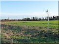
Footpath from Apethorpe Road to Nassington
The spire of Nassington Church is on the skyline.
Image: © Christine Johnstone
Taken: 28 Dec 2011
0.14 miles
7

Elsie's Vintage Tea Room, Nassington
Image: © Jonathan Thacker
Taken: 16 Apr 2023
0.15 miles
8

Apethorpe Road
Taken from the older 40 metre spot height, just west of Nassington.
Image: © Christine Johnstone
Taken: 28 Dec 2011
0.16 miles
9

Blackthorn by a restricted byway, Nassington
Image: © Jonathan Thacker
Taken: 16 Apr 2023
0.16 miles
10

Three Mill Bills, Nassingon
Dates from the seventeenth century https://historicengland.org.uk/listing/the-list/list-entry/1357440?section=official-list-entry This was once a public house.
Image: © Jonathan Thacker
Taken: 16 Apr 2023
0.18 miles