
IMAGES TAKEN NEAR TO
Apethorpe, PETERBOROUGH, PE8 5DW
Introduction
This page details the photographs taken nearby to PE8 5DW by members of the Geograph project.
The Geograph project started in 2005 with the aim of publishing, organising and preserving representative images for every square kilometre of Great Britain, Ireland and the Isle of Man.

There are currently over 7.5m images from over14,400 individuals and you can help contribute to the project by visiting https://www.geograph.org.uk
Image Map
Images are licensed for reuse under creativecommons.org/licenses/by-sa/2.0
Notes
- Clicking on the map will re-center to the selected point.
- The higher the marker number, the further away the image location is from the centre of the postcode.
Image Listing (11 Images Found)
Images are licensed for reuse under creativecommons.org/licenses/by-sa/2.0
Image
Details
Distance
1

Bluefield Farm
There are several homes here, as well as farm buildings.
Image: © Christine Johnstone
Taken: 28 Dec 2011
0.01 miles
2

Red in Green
These red farm buildings in a sea of green fields is known as Bluefield Farm.
Image: © Michael Patterson
Taken: 14 Jun 2006
0.10 miles
3
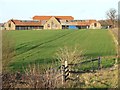
Buildings under conversion, Bluefield Farm
Planning permission was granted to convert these farm buildings into 'employment use' in March 2003.
Image: © Christine Johnstone
Taken: 28 Dec 2011
0.12 miles
4

Winter hedgerow tree
At the edge of Bushrubs Woods, just south of Bluefield Farm.
Image: © Christine Johnstone
Taken: 28 Dec 2011
0.13 miles
5
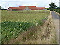
Bluefield Farm near Apethorpe
This range of farm buildings has been converted to holiday lets according to Rightmove "A range of brick barns on a site of 1.64 acres with New Planning Permission for the development of seven holiday dwellings plus managers accommodation, set in an outstanding rural position."
Image: © Richard Humphrey
Taken: 21 Jul 2015
0.13 miles
6
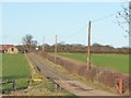
Access track to Bluefield Farm
From its junction with Apethorpe Road.
Image: © Christine Johnstone
Taken: 28 Dec 2011
0.16 miles
7

Apethorpe Road
Just south of Blue Field Lodge.
Image: © Christine Johnstone
Taken: 28 Dec 2011
0.19 miles
8

Double gates into large crop field
South of Apethorpe Road.
Image: © Christine Johnstone
Taken: 28 Dec 2011
0.21 miles
9
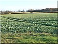
X marks the spot
Tractor tracks in a crop field south of Apethorpe Road mimicking the hedged field boundaries in the distance.
Image: © Christine Johnstone
Taken: 28 Dec 2011
0.21 miles
10
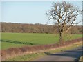
Roadside tree and its shadow
On the north side of Apethorpe Road on a December afternoon.
Image: © Christine Johnstone
Taken: 28 Dec 2011
0.23 miles