
IMAGES TAKEN NEAR TO
Fleming Close, PETERBOROUGH, PE7 3ZD
Introduction
This page details the photographs taken nearby to Fleming Close, PE7 3ZD by members of the Geograph project.
The Geograph project started in 2005 with the aim of publishing, organising and preserving representative images for every square kilometre of Great Britain, Ireland and the Isle of Man.

There are currently over 7.5m images from over14,400 individuals and you can help contribute to the project by visiting https://www.geograph.org.uk
Image Map
Images are licensed for reuse under creativecommons.org/licenses/by-sa/2.0
Notes
- Clicking on the map will re-center to the selected point.
- The higher the marker number, the further away the image location is from the centre of the postcode.
Image Listing (6 Images Found)
Images are licensed for reuse under creativecommons.org/licenses/by-sa/2.0
Image
Details
Distance


4
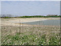
Former London Brick clay pit near Yaxley
One of the last pits near Yaxley to be worked for clay extraction. After laying abandoned for a few years, the sides have been re-profiled to make them safe.Unsure of the intended use other than a nature reserve in the making. The large area of land between Yaxley and Peterborough that was mostly clay pits and associated works is and will be covered with houses, factories and warehouses making the most of reclaimed brown field sites.
Image: © Michael Trolove
Taken: 2 May 2009
0.25 miles

6

Woods in Yaxley
By Lodge Way and London Road
Image: © David Howard
Taken: 15 Jun 2025
0.25 miles