
IMAGES TAKEN NEAR TO
Queen Street, PETERBOROUGH, PE7 3JF
Introduction
This page details the photographs taken nearby to Queen Street, PE7 3JF by members of the Geograph project.
The Geograph project started in 2005 with the aim of publishing, organising and preserving representative images for every square kilometre of Great Britain, Ireland and the Isle of Man.

There are currently over 7.5m images from over14,400 individuals and you can help contribute to the project by visiting https://www.geograph.org.uk
Image Map
Images are licensed for reuse under creativecommons.org/licenses/by-sa/2.0
Notes
- Clicking on the map will re-center to the selected point.
- The higher the marker number, the further away the image location is from the centre of the postcode.
Image Listing (4 Images Found)
Images are licensed for reuse under creativecommons.org/licenses/by-sa/2.0
Image
Details
Distance
1
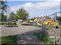
The builders are in
The site compound for a construction company who are improving and installing a shared use cycle footpath on Yaxley Broadway which is the main thoroughfare through the village. A mix of heavy haulage and young children cycling to school highlights the need for improved cycling facilities.
Image: © Michael Trolove
Taken: 18 Apr 2009
0.10 miles
2
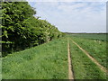
Footpath towards Peterborough
From Yaxley the path takes you towards the clay pit where a sharp left turn leads you alongside the pit before coming out on the side of the A15.
Image: © Michael Trolove
Taken: 2 May 2009
0.19 miles
3
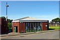
Yaxley Library
Small community library near the shopping centre in Lansdowne Road. http://www.cambridgeshire.gov.uk/leisure/libraries/directory/yaxley_library.htm
Image: © Tiger
Taken: 15 Aug 2008
0.20 miles
4
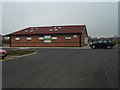
Queens Park Sports Ground Yaxley
A new sports facility courtesy of the Football Foundation and other bodies in the centre of Yaxley.
Image: © Michael Trolove
Taken: 10 Jan 2009
0.24 miles