
IMAGES TAKEN NEAR TO
Minuet Paddocks, PETERBOROUGH, PE7 2DQ
Introduction
This page details the photographs taken nearby to Minuet Paddocks, PE7 2DQ by members of the Geograph project.
The Geograph project started in 2005 with the aim of publishing, organising and preserving representative images for every square kilometre of Great Britain, Ireland and the Isle of Man.

There are currently over 7.5m images from over14,400 individuals and you can help contribute to the project by visiting https://www.geograph.org.uk
Image Map
Images are licensed for reuse under creativecommons.org/licenses/by-sa/2.0
Notes
- Clicking on the map will re-center to the selected point.
- The higher the marker number, the further away the image location is from the centre of the postcode.
Image Listing (5 Images Found)
Images are licensed for reuse under creativecommons.org/licenses/by-sa/2.0
Image
Details
Distance
1
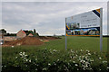
Development on the edge of Coates
Rather grandly named Minuet Village. Looks like a fairly standard expansion of an existing mid-sized village.
Image: © Hugh Venables
Taken: 5 May 2019
0.03 miles
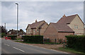
3

Whitecross Stone, Coates
Marked as an antiquity on OS maps, its original purpose is uncertain. It is described in the Historic England Pastscape section as “A free standing stone pillar, possibly a late Medieval milestone.”
Image: © Alan Murray-Rust
Taken: 26 Jun 2016
0.05 miles
4

Whitecross Stone?
'Whitecross Stone' is marked on the 1:50,000 map and gives its name to Whitecross Farm, which is nearby. If this is it, it's not exactly spectacular, and any information which may exist about it online is lost in a welter of irrelevancy.
Image: © Anne Burgess
Taken: 26 Jun 2016
0.06 miles
5
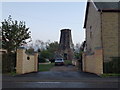
Old mill tower in Coates near Whittlesey
The cap is currently on the floor
Image: © Richard Humphrey
Taken: 27 Oct 2012
0.07 miles