
IMAGES TAKEN NEAR TO
Station Road, PETERBOROUGH, PE7 1UE
Introduction
This page details the photographs taken nearby to Station Road, PE7 1UE by members of the Geograph project.
The Geograph project started in 2005 with the aim of publishing, organising and preserving representative images for every square kilometre of Great Britain, Ireland and the Isle of Man.

There are currently over 7.5m images from over14,400 individuals and you can help contribute to the project by visiting https://www.geograph.org.uk
Image Map
Images are licensed for reuse under creativecommons.org/licenses/by-sa/2.0
Notes
- Clicking on the map will re-center to the selected point.
- The higher the marker number, the further away the image location is from the centre of the postcode.
Image Listing (26 Images Found)
Images are licensed for reuse under creativecommons.org/licenses/by-sa/2.0
Image
Details
Distance


3

Ashline Lock
Ashline Lock is close to Whittlesey and is the only one on the Middle Level which is boater operated at all times. It was originally re-instated as a short lock but later extended so that most narrow boats can now access the whole of the Middle Level and thus navigate through to Cambridge and Bedford.
Image: © Mike Todd
Taken: 15 Jun 2010
0.14 miles
4

Ashline Lock Penstock
Ashline Lock is boater operated and requires a windlass of different dimensions from all other locks. They can be bought at Stanground Lock. There are few locks which are operated by vertically mounted mechanisms such as this, although several may be found on the Leeds and Liverpool, near Leeds. The term 'penstock' is the term used by the Fenland waterways for what is generally called a paddle (mechanism)
Image: © Mike Todd
Taken: 15 Jun 2010
0.14 miles
5

Ashline Lock Plaque
Ashline Lock was previously shorter than most locks (significantly shorter than those at Stanground and Salters Lode which control access to the Middle Level) but was extended in 1999, significantly opening access to Cambridge and Bedford for the longer boats normally found on the main canal network.
Image: © Mike Todd
Taken: 15 Jun 2010
0.14 miles
6

New housing on Scaldgate in Whittlesey
Image: © Richard Humphrey
Taken: 4 Apr 2020
0.15 miles

8

Ashline Lock on Briggate River in Whittlesey
Image: © Richard Humphrey
Taken: 4 Apr 2020
0.17 miles

10
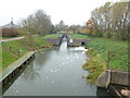
Ashline Lock, Whittlesey
This waterway appears to change names - King's Dyke becomes Briggate River and then Whittlesey Dike
Image: © Richard Humphrey
Taken: 16 Nov 2012
0.17 miles