
IMAGES TAKEN NEAR TO
Churchfield Way, PETERBOROUGH, PE7 1JU
Introduction
This page details the photographs taken nearby to Churchfield Way, PE7 1JU by members of the Geograph project.
The Geograph project started in 2005 with the aim of publishing, organising and preserving representative images for every square kilometre of Great Britain, Ireland and the Isle of Man.

There are currently over 7.5m images from over14,400 individuals and you can help contribute to the project by visiting https://www.geograph.org.uk
Image Map
Images are licensed for reuse under creativecommons.org/licenses/by-sa/2.0
Notes
- Clicking on the map will re-center to the selected point.
- The higher the marker number, the further away the image location is from the centre of the postcode.
Image Listing (31 Images Found)
Images are licensed for reuse under creativecommons.org/licenses/by-sa/2.0
Image
Details
Distance
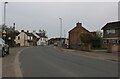
2
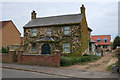
Houses on Hallcroft Road
Infill house behind an existing house.
Image: © Hugh Venables
Taken: 5 May 2019
0.08 miles
6
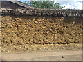
Thatched cob wall, West End, Whittlesey
Photographed from a number 33 bus as it was moving away from the bus stop towards the village centre.
Image: © Robin Stott
Taken: 24 Jun 2016
0.17 miles


10

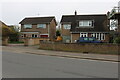
St Andrew's Church, Whittlesey
Taken early one September morning in 2002 whilst researching my ancestors. I understand that the trees have since been cut down.
Image: © Dave Hilliam
Taken: 10 Sep 2002
0.21 miles