
IMAGES TAKEN NEAR TO
Glenfields, PETERBOROUGH, PE7 1HY
Introduction
This page details the photographs taken nearby to Glenfields, PE7 1HY by members of the Geograph project.
The Geograph project started in 2005 with the aim of publishing, organising and preserving representative images for every square kilometre of Great Britain, Ireland and the Isle of Man.

There are currently over 7.5m images from over14,400 individuals and you can help contribute to the project by visiting https://www.geograph.org.uk
Image Map
Images are licensed for reuse under creativecommons.org/licenses/by-sa/2.0
Notes
- Clicking on the map will re-center to the selected point.
- The higher the marker number, the further away the image location is from the centre of the postcode.
Image Listing (15 Images Found)
Images are licensed for reuse under creativecommons.org/licenses/by-sa/2.0
Image
Details
Distance
1
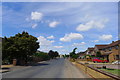
Stonal Road, Whittlesey - 2
The long, straight road on the north side of Whittlesey follows the course of a Roman road (the Fen Causeway), and is seen here continuing west, out of the town, towards Stonald Field. 'Stonald' seems to be a name peculiar to Whittlesey, and may derive from 'stone corner' http://epns.nottingham.ac.uk/browse/id/53287358b47fc40c4f0005bf
Image: © Tim Heaton
Taken: 12 Jul 2020
0.06 miles
2

Stonald Road, Whittlesey
The Hereward Way and Cycle Route 63 following the course of the 'Fen Causeway' Roman road along the north side of Whittlesey. The 'ston' part of the road's name might derive from 'stan' = 'gravel' https://epns.nottingham.ac.uk/browse/The+Isle+of+Ely/Whittlesey/53287358b47fc40c4f0005bf-Stonald+Field , a reference to the hard surface of Roman roads.
Image: © Tim Heaton
Taken: 14 May 2025
0.07 miles

4

Water tower, Whittlesey, Cambs
adjacent to the Peterborough Road.
Image: © Rodney Burton
Taken: 15 Apr 2006
0.19 miles
5

Whittlesey Windmill new roof
A new roof was lifted on to Whittlesey windmill on 27th November 2008. This was constructed on an ash frame and weighed a total of 4.2tons.
Image: © Mr K Almond
Taken: 21 Dec 2008
0.19 miles
6

Colourful shed on the outskirts of Whittlesey
On Stonald Road which follows the line of The Fen Causeway an ancient road built by The Romans
Image: © Richard Humphrey
Taken: 9 Nov 2012
0.20 miles
7

Water tower, Whittlesey
Off Peterborough Road.
Image: © JThomas
Taken: 21 Sep 2012
0.20 miles
8

Water tower beside the A605 at Whittlesey
Image: © Rod Allday
Taken: 14 Sep 2012
0.20 miles
9

Elderkin's windmill, Whittlesey, Cambs
Derelict, capless tower mill adjacent to West End.
Now has a beautiful ogee-style roof! Dec 08
Image: © Rodney Burton
Taken: 15 Apr 2006
0.20 miles
