
IMAGES TAKEN NEAR TO
Deeping Road, PETERBOROUGH, PE6 9NW
Introduction
This page details the photographs taken nearby to Deeping Road, PE6 9NW by members of the Geograph project.
The Geograph project started in 2005 with the aim of publishing, organising and preserving representative images for every square kilometre of Great Britain, Ireland and the Isle of Man.

There are currently over 7.5m images from over14,400 individuals and you can help contribute to the project by visiting https://www.geograph.org.uk
Image Map
Images are licensed for reuse under creativecommons.org/licenses/by-sa/2.0
Notes
- Clicking on the map will re-center to the selected point.
- The higher the marker number, the further away the image location is from the centre of the postcode.
Image Listing (22 Images Found)
Images are licensed for reuse under creativecommons.org/licenses/by-sa/2.0
Image
Details
Distance
1
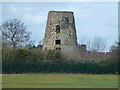
The remains of Hudson's Mill
Alongside Deeping Road, A15, between Baston and Langtoft
Said to have been built in 1806, this tower mill worked until the Great War and was then dismantled. The machinery is thought to have been taken to another mill. It had four patent sails and probably drove two pairs of stones. The stone tower, once rendered, stands on a low mound (which suggests an older mill site) and is now virtually a shell with only a few floor beams remaining. Part of the cap frame lingers on at the top. In its later working life it lost a sail when a wagon came too close for comfort. (Ref Lincolnshire.gov.uk)
Image: © Richard Humphrey
Taken: 21 Feb 2014
0.02 miles
3
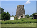
Hudson's Mill, Baston, Lincs
Here are the remains of a once-rendered stone tower mill beside the A15 Deeping Road south of the village. Said to have been built in 1806, this mill worked until the Great War and was then dismantled. http://www.lincolnshire.gov.uk/windmills/section.asp?catId=3422
Image: © Rodney Burton
Taken: 2 Jun 2007
0.02 miles


6

Hudson?s Mill at Baston, near Bourne, Lincolnshire
The old corn mill built at Baston in 1806 survives as a Grade II listed building known as Hudson’s Mill, a tower mill with four patent sails which was worked until the Great War when it was dismantled and the machinery probably used for another mill elsewhere. The stone tower, until recently covered with creeper, is now virtually a shell with only a few floor beams remaining yet is still a reminder of its former grandeur.
Image: © Rex Needle
Taken: 21 Nov 1999
0.02 miles
7

Remains of Hudson's Mill
The dilapidated, overgrown remains of Hudson's Mill, Windmill Farm, Baston.
Image: © Ajay Tegala
Taken: 8 Oct 2008
0.03 miles
8

Old windmill
The remains of Hudson’s Mill, a former windmill alongside the A15 on the southern approach to Baston. . It once had four sails to turn the hefty machinery inside; once was lost when a farm wagon came too close. However, advances in technology rendered the mill obsolete and it is now just a shell with only a few floor beams remaining.
Image: © Robin Jones
Taken: 27 Oct 2007
0.04 miles

