
IMAGES TAKEN NEAR TO
King Street, PETERBOROUGH, PE6 9JE
Introduction
This page details the photographs taken nearby to King Street, PE6 9JE by members of the Geograph project.
The Geograph project started in 2005 with the aim of publishing, organising and preserving representative images for every square kilometre of Great Britain, Ireland and the Isle of Man.

There are currently over 7.5m images from over14,400 individuals and you can help contribute to the project by visiting https://www.geograph.org.uk
Image Map
Images are licensed for reuse under creativecommons.org/licenses/by-sa/2.0
Notes
- Clicking on the map will re-center to the selected point.
- The higher the marker number, the further away the image location is from the centre of the postcode.
Image Listing (67 Images Found)
Images are licensed for reuse under creativecommons.org/licenses/by-sa/2.0
Image
Details
Distance
1

Field near Lolham Mill
Rather to the south of West Deeping, this is a 120 degree panorama of a simple field, made by stitching 8 images together using Microsoft Image Composite Editor.
Image: © Bob Harvey
Taken: 25 Jun 2022
0.04 miles
2

Along a Roman Road
This is King Street, the B1443, south of West Deeping.
Image: © Bob Harvey
Taken: 25 Jun 2022
0.06 miles
3

A diseased Horse Chestnut
These leaves are heavily infected with the Horse chestnut leaf miner
(Cameraria ohridella) whose larvae tunnel within the leaves.
Image: © Bob Harvey
Taken: 25 Jun 2022
0.09 miles
4

Panorama of Little Meadow
180 degree view from the public footpath, stitched from 16 single images of 4416 x 2944 pixels, stitched with Microsoft Image Composite Editor to give an image of 23114 x 4579 pixels. It has been scaled down to fit on Geograph.
Image: © Bob Harvey
Taken: 9 Jul 2022
0.09 miles
5

Distributary of the River Welland
– view E near the Lincs–Peterborough border.
Image: © Rodney Burton
Taken: 4 Dec 2005
0.09 miles

7
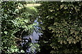
A glimpse of the Welland
The waters of that part of the Welland that passes under Image, looking downstream.
Image: © Bob Harvey
Taken: 25 Jun 2022
0.09 miles
8

King Street passing over the River Welland
The River Welland is split into two main branches at West Deeping, although the main flow is taken by the Maxey Cut to the south. This is where King Street crosses the southernmost of the two subsidiary branches.
Image: © Marathon
Taken: 3 May 2013
0.10 miles
9
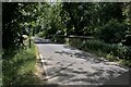
Bridge across the Welland
The River Welland has a confused identity between Uffington and Market Deeping, flowing in several channels, including this one which skirts Lolham Mill on the Northern side. This is the Roman Road of King Street, and it crosses what must have been marshy territory at the time in a straight line. There must have been Roman Bridge near here, although this one is a bit later. This is the 18th century incarnation of a bridge, and is grade II listed - see https://historicengland.org.uk/listing/the-list/list-entry/1165282 .
Image: © Bob Harvey
Taken: 25 Jun 2022
0.10 miles
10

Arched bridge over the Welland
The western face of Image, the 18th century incarnation of this bridge, which is grade II listed - see https://historicengland.org.uk/listing/the-list/list-entry/1165282 . Since the road is the dead-straight Roman King Street, there must have been bridges hereabouts for a couple of millennia, although I cannot be so certain about the course of the River, which is probably extremely variable in these wide, marshy fields.
Image: © Bob Harvey
Taken: 25 Jun 2022
0.10 miles