IMAGES TAKEN NEAR TO
Rippons Drove, PETERBOROUGH, PE6 9AG
Introduction
This page details the photographs taken nearby to Rippons Drove, PE6 9AG by members of the Geograph project.
The Geograph project started in 2005 with the aim of publishing, organising and preserving representative images for every square kilometre of Great Britain, Ireland and the Isle of Man.

There are currently over 7.5m images from over14,400 individuals and you can help contribute to the project by visiting https://www.geograph.org.uk
Image Map
Images are licensed for reuse under creativecommons.org/licenses/by-sa/2.0
Notes
- Clicking on the map will re-center to the selected point.
- The higher the marker number, the further away the image location is from the centre of the postcode.
Image Listing (11 Images Found)
Images are licensed for reuse under creativecommons.org/licenses/by-sa/2.0
Image
Details
Distance
1
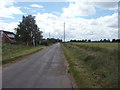
Rippon's Drove
A Fenland drove north of Northborough, and home to B&G Plants garden centre. Halfway along, this road crosses the course of Car Dyke.
Image: © Ajay Tegala
Taken: 29 Jun 2008
0.05 miles
2
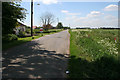
Rippon's Drove
Many of the lanes, tracks and country roads through the Fens carry the name "Drove", an old name given to routes that were used to move livestock.
Image: © Kate Jewell
Taken: 22 May 2007
0.07 miles



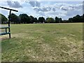
7
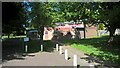
Northborough and Deeping Gate Village Hall
The village hall, which is located on Cromwell Close, was opened in 1975 and was subsequently extended. It was built to cater for a rapid expansion of Northborough's population in the 1970s when a new housing estate was constructed. Northborough numbered 1,318 residents at the time of the 2011 United Kingdom national census. The hall also serves the neighbouring village of Deeping Gate.
Sources: https://northborough-pc.gov.uk/the-parish/
https://en.wikipedia.org/wiki/Northborough,_Cambridgeshire
Image: © Paul Bryan
Taken: 27 May 2022
0.23 miles
8

North Fen
Looking towards Peakirk Road from Rippon's Drove.
Image: © Kate Jewell
Taken: 22 May 2007
0.23 miles
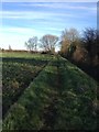
9

High hedge north of Rippons Drove
It screens The Willows Poultry Farm near Deeping St James
Image: © Richard Humphrey
Taken: 28 Dec 2013
0.24 miles