
IMAGES TAKEN NEAR TO
Hereward Way, PETERBOROUGH, PE6 8QB
Introduction
This page details the photographs taken nearby to Hereward Way, PE6 8QB by members of the Geograph project.
The Geograph project started in 2005 with the aim of publishing, organising and preserving representative images for every square kilometre of Great Britain, Ireland and the Isle of Man.

There are currently over 7.5m images from over14,400 individuals and you can help contribute to the project by visiting https://www.geograph.org.uk
Image Map
Images are licensed for reuse under creativecommons.org/licenses/by-sa/2.0
Notes
- Clicking on the map will re-center to the selected point.
- The higher the marker number, the further away the image location is from the centre of the postcode.
Image Listing (171 Images Found)
Images are licensed for reuse under creativecommons.org/licenses/by-sa/2.0
Image
Details
Distance

2

Old Milepost
Old milepost on Church Street Deeping St.James, Lincolnshire for overall view see http://www.geograph.org.uk/photo/2868495
Image: © Keith Evans
Taken: 24 Mar 2012
0.11 miles
3

Old Milepost
Old milepost on Church Street Deeping St.James, Lincolnshire for close up view see http://www.geograph.org.uk/photo/2868491
Image: © Keith Evans
Taken: 24 Mar 2012
0.11 miles

5

Methodist Church, Deeping: late June 2016
Image: © Basher Eyre
Taken: 25 Jun 2016
0.11 miles
6

2016: a year on Geograph (Day 177)
Ducks can depend on decent treatment at Deeping!
Image: © Basher Eyre
Taken: 25 Jun 2016
0.12 miles
7

Old Milestone, on the B1166, Church Street
Outside No 40/42. Located on the North side of road, in pavement against wall. Cast iron post, Thorncliffe iron casting design, erected by Littleworth turnpike trust, 19th century. Alternative views see http://www.geograph.org.uk/photo/2868495 & http://www.geograph.org.uk/photo/2868491
Inscription reads: // SPALDING / 11 // DEEPING / ST JAMES / // LONDON / M / 89
Grade II listed by Historic England.
Milestone Society National ID: LI_SPDJ11
Image: © Milestone Society
Taken: Unknown
0.13 miles
8
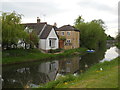
Houses alongside the River Welland, Deeping Gate
Image: © Paul Bryan
Taken: 4 May 2014
0.13 miles
9

Houses alongside the River Welland, Deeping Gate
Image: © Paul Bryan
Taken: 4 May 2014
0.13 miles
