
IMAGES TAKEN NEAR TO
Park Road, PETERBOROUGH, PE6 8NF
Introduction
This page details the photographs taken nearby to Park Road, PE6 8NF by members of the Geograph project.
The Geograph project started in 2005 with the aim of publishing, organising and preserving representative images for every square kilometre of Great Britain, Ireland and the Isle of Man.

There are currently over 7.5m images from over14,400 individuals and you can help contribute to the project by visiting https://www.geograph.org.uk
Image Map
Images are licensed for reuse under creativecommons.org/licenses/by-sa/2.0
Notes
- Clicking on the map will re-center to the selected point.
- The higher the marker number, the further away the image location is from the centre of the postcode.
Image Listing (137 Images Found)
Images are licensed for reuse under creativecommons.org/licenses/by-sa/2.0
Image
Details
Distance
1

The Bell
Across Deeping Gate Bridge http://www.geograph.org.uk/photo/705153 to The Bell on the Lincolnshire side of the River Welland
Image: © Richard Croft
Taken: 25 Feb 2008
0.18 miles
2

Deeping Gate Bridge
Looking across the River Welland to the Bell on the Lincolnshire side of the bridge
Image: © Richard Croft
Taken: 25 Feb 2008
0.18 miles
3

A bit of History
An outbuilding that obviously has a tale to tell. Unfortunately, I don't know what.
Image: © Bob Harvey
Taken: 25 Jun 2022
0.19 miles

5

The Bell, Deeping St. James
The Bell is located on Bridge Street opposite the junction with Deeping St. James Road. The pub is seen here from the south bank of the River Welland. The pack horse bridge, which was built in 1651, can be seen in the foreground.
Image: © Paul Bryan
Taken: 4 May 2014
0.19 miles
6

The Bell, Deeping St. James
The Bell is located on Bridge Street opposite the junction with Deeping St. James Road.
Image: © Paul Bryan
Taken: 4 May 2014
0.19 miles
7

The Bell, Deeping St. James
The Bell is located on Bridge Street opposite the junction with Deeping St. James Road. The pub is seen here from the south side of the pack horse bridge over the River Welland, which was built in 1651.
Image: © Paul Bryan
Taken: 4 May 2014
0.19 miles
8

The Bell, Deeping St. James
The Bell is located on Bridge Street opposite the junction with Deeping St. James Road. The pub is seen here from the south bank of the River Welland. The pack horse bridge, which was built in 1651, can be seen in the foreground.
Image: © Paul Bryan
Taken: 4 May 2014
0.19 miles
9
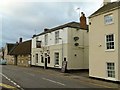
Bell Inn, Deeping St James
Conveniently sited at the crossing of the River Welland.
Image: © Alan Murray-Rust
Taken: 14 Sep 2015
0.19 miles
10
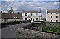
The Bell Inn
Seen from the other side of the bridge over the River Welland. The pub is in the parish of Deeping St James, and I am stood in the parish of Deeping Gate.
A local legend tells that the pub is haunted. There is a famous lock-up nearby, and two drunken men apparently killed each other whilst incarcerated therein. The bodies were removed to the Bell Inn for an inquest, and their spirits have bothered the occupants ever since.
See Image for the inn sign.
Image: © Bob Harvey
Taken: 25 Jun 2022
0.19 miles