
IMAGES TAKEN NEAR TO
Kesteven Close, PETERBOROUGH, PE6 8JW
Introduction
This page details the photographs taken nearby to Kesteven Close, PE6 8JW by members of the Geograph project.
The Geograph project started in 2005 with the aim of publishing, organising and preserving representative images for every square kilometre of Great Britain, Ireland and the Isle of Man.

There are currently over 7.5m images from over14,400 individuals and you can help contribute to the project by visiting https://www.geograph.org.uk
Image Map
Images are licensed for reuse under creativecommons.org/licenses/by-sa/2.0
Notes
- Clicking on the map will re-center to the selected point.
- The higher the marker number, the further away the image location is from the centre of the postcode.
Image Listing (34 Images Found)
Images are licensed for reuse under creativecommons.org/licenses/by-sa/2.0
Image
Details
Distance
1
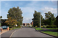
Wade Park Avenue
Looking along Wade Park Avenue from its junction with Godsey Lane.
Image: © Ajay Tegala
Taken: 13 Sep 2008
0.10 miles
3
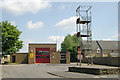
Market Deeping fire station
Market Deeping fire station, 95 High Street, Market Deeping, Lincolnshire
Image: © Kevin Hale
Taken: 31 May 2008
0.14 miles

5
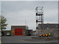
Market Deeping fire station
The fire station, which is situated on High Street close to the junction with Bridge Street and Godsey Lane, was built in the mid-1970s.
Image: © Paul Bryan
Taken: 2 May 2015
0.15 miles
6

Roundabout on High Street, Market Deeping
With Market Deeping Police Station behind.
Image: © Tim Heaton
Taken: 20 Jun 2024
0.16 miles
7
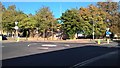
Market Deeping police station
The police station is located on High Street at the junction with Godsey Lane.
Image: © Paul Bryan
Taken: 27 Sep 2018
0.16 miles
8
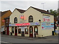
The Boundary fish and chip shop, Market Deeping
As can be seen from the street signs on the front of the shop, The Boundary is so-called because the right-hand side of the building is situated on High Street, Market Deeping, and the left-hand side on Bridge Street, Deeping St. James, thus straddling the boundary. It originally served as a general store from 1890 and was converted into a fish and chip shop and hairdressing salon in around 1945 or 1946. The fish and chip shop was later expanded to occupy the whole of the property. Previously a takeaway-only outlet, the bungalow to the rear of the shop was opened as a restaurant in November 2008.
Source: http://www.lincolnshirelife.co.uk/posts/view/picturesque-borders
Image: © Paul Bryan
Taken: 2 May 2015
0.17 miles
9
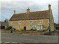
100 Bridge Street, Deeping St James
Otherwise known as The Rundles, and now the Treetops Caterpillar Nursery.
Late 17th century house in coursed limestone rubble with Collyweston stone slate roof. The windows are largely 20th century replacements. Listed Grade II.
Image: © Alan Murray-Rust
Taken: 14 Sep 2015
0.18 miles
10

Old Direction Sign - Signpost by the B1525, Horsegate, Deeping St James
Annulus finial - 3 arms; Kesteven CC halo by the B1525, in parish of Deeping St James (South Kesteven District), Horsegate junction with Bridge Street, on footway, South side of road.
Surveyed
Milestone Society National ID: LI_TF1409
Image: © Milestone Society
Taken: Unknown
0.19 miles