
IMAGES TAKEN NEAR TO
Church Street, PETERBOROUGH, PE6 8HF
Introduction
This page details the photographs taken nearby to Church Street, PE6 8HF by members of the Geograph project.
The Geograph project started in 2005 with the aim of publishing, organising and preserving representative images for every square kilometre of Great Britain, Ireland and the Isle of Man.

There are currently over 7.5m images from over14,400 individuals and you can help contribute to the project by visiting https://www.geograph.org.uk
Image Map
Images are licensed for reuse under creativecommons.org/licenses/by-sa/2.0
Notes
- Clicking on the map will re-center to the selected point.
- The higher the marker number, the further away the image location is from the centre of the postcode.
Image Listing (115 Images Found)
Images are licensed for reuse under creativecommons.org/licenses/by-sa/2.0
Image
Details
Distance
1

Old Milestone, on the B1166, Church Street
Outside No 40/42. Located on the North side of road, in pavement against wall. Cast iron post, Thorncliffe iron casting design, erected by Littleworth turnpike trust, 19th century. Alternative views see http://www.geograph.org.uk/photo/2868495 & http://www.geograph.org.uk/photo/2868491
Inscription reads: // SPALDING / 11 // DEEPING / ST JAMES / // LONDON / M / 89
Grade II listed by Historic England.
Milestone Society National ID: LI_SPDJ11
Image: © Milestone Society
Taken: Unknown
0.02 miles
2
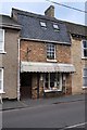
The Old Bakery
A hidden gem. A craft bakery, with a small cafe upstairs. Recommended.
Clive Hankers makes use of the coal-fired, externally fired, bake oven installed in about 1900.
Image: © Bob Harvey
Taken: 4 Jan 2020
0.04 miles
3
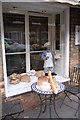
Window display at the Bakery
The window, and pavement seating, at Image - complete with animated model baker.
Image: © Bob Harvey
Taken: 4 Jan 2020
0.04 miles
4
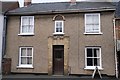
1932 house
House with the date 1932 above the upstairs window
Image: © Bob Harvey
Taken: 4 Jan 2020
0.04 miles
5

Old Milepost
Old milepost on Church Street Deeping St.James, Lincolnshire for overall view see http://www.geograph.org.uk/photo/2868495
Image: © Keith Evans
Taken: 24 Mar 2012
0.05 miles
6

Old Milepost
Old milepost on Church Street Deeping St.James, Lincolnshire for close up view see http://www.geograph.org.uk/photo/2868491
Image: © Keith Evans
Taken: 24 Mar 2012
0.05 miles
7

Bus shelter
The bus shelter outside the Vicarage was erected by the parish council. The Delaine service between Stamford and Spalding does not pass this spot. Only the call connect buses use this bus stop.
Image: © Bob Harvey
Taken: 4 Jan 2020
0.06 miles

9

Vicarage and Church
Unusually the Vicarage is still in use for the local incumbent. The church of St James is visible beyond.
Image: © Bob Harvey
Taken: 4 Jan 2020
0.07 miles
10

A modern bungalow
1960s or 1970s. I favour 1960s, from the chimney.
Built before the curse of the plastic horrors that now decorate the front of the house, the varicoloured wheelybins
Image: © Bob Harvey
Taken: 4 Jan 2020
0.07 miles