
IMAGES TAKEN NEAR TO
The Willows, PETERBOROUGH, PE6 7NE
Introduction
This page details the photographs taken nearby to The Willows, PE6 7NE by members of the Geograph project.
The Geograph project started in 2005 with the aim of publishing, organising and preserving representative images for every square kilometre of Great Britain, Ireland and the Isle of Man.

There are currently over 7.5m images from over14,400 individuals and you can help contribute to the project by visiting https://www.geograph.org.uk
Image Map
Images are licensed for reuse under creativecommons.org/licenses/by-sa/2.0
Notes
- Clicking on the map will re-center to the selected point.
- The higher the marker number, the further away the image location is from the centre of the postcode.
Image Listing (98 Images Found)
Images are licensed for reuse under creativecommons.org/licenses/by-sa/2.0
Image
Details
Distance
1
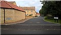
Dovecote Way, Glinton
This high-end residential development off Welmore Road was completed in 2019. It was built on land which previously formed part of Scott's Farm.
Image: © Paul Bryan
Taken: 13 Oct 2019
0.06 miles

3
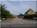
Scotts Road, Glinton
The streets on this council housing estate, built in the late 1940s, were all named after local farming families and local councillors (Scotts Road, Neaverson Road, Holmes Road, Vergette Road and Walker Road).
Image: © Paul Bryan
Taken: 23 Aug 2013
0.08 miles


6

Peakirk Road, Glinton, in the winter
The west end of Peakirk Road near to the junction with High Street and Welmore Road. The gateway on the right is the entrance to Scotts Farm.
Image: © Paul Bryan
Taken: 22 Dec 2009
0.09 miles
7

Clarendon Way, Glinton
This residential development, situated off Peakirk Road, was built between 1996 and 1998.
Image: © Paul Bryan
Taken: 17 Oct 2013
0.10 miles
8

Snowman on Peakirk Road, Glinton
This snowman was built in the traditional manner with a carrot for his nose, small lumps of coal for his eyes and the buttons of his coat and twigs for his arms.
Image: © Paul Bryan
Taken: 25 Jan 2021
0.10 miles
9
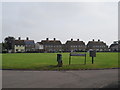
Neaverson Road, Glinton
The streets on this council housing estate, built in the late 1940s, were all named after local farming families and local councillors. The houses in the background are located on Walker Road.
Image: © Paul Bryan
Taken: 12 Oct 2014
0.10 miles
10

Welmore Road, Glinton
Welmore Road is viewed here from the junction with High Street and Peakirk Road.
Image: © Paul Bryan
Taken: 23 Aug 2013
0.10 miles