
IMAGES TAKEN NEAR TO
Lincoln Road, PETERBOROUGH, PE6 7LW
Introduction
This page details the photographs taken nearby to Lincoln Road, PE6 7LW by members of the Geograph project.
The Geograph project started in 2005 with the aim of publishing, organising and preserving representative images for every square kilometre of Great Britain, Ireland and the Isle of Man.

There are currently over 7.5m images from over14,400 individuals and you can help contribute to the project by visiting https://www.geograph.org.uk
Image Map
Images are licensed for reuse under creativecommons.org/licenses/by-sa/2.0
Notes
- Clicking on the map will re-center to the selected point.
- The higher the marker number, the further away the image location is from the centre of the postcode.
Image Listing (26 Images Found)
Images are licensed for reuse under creativecommons.org/licenses/by-sa/2.0
Image
Details
Distance
1

Waterworks Lane, Glinton
Waterworks Lane is so-called because the former Peterborough Corporation Water Works - now owned and operated by Anglian Water - was opened at the western end of the lane in 1907. The road in the foreground of the image is a short section of Lincoln Road which was formerly part of the main A15 route into Peterborough. It was blocked off when the A15 Glinton bypass opened in February 1989 and is now a dead-end providing residents' access to three houses situated to the south of the roundabout.
Image: © Paul Bryan
Taken: 31 Dec 2015
0.02 miles
2
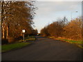
Section of former A15, Glinton
This short section of Lincoln Road to the south of Glinton was formerly part of the main A15 route into Peterborough. It was blocked off when the A15 Glinton bypass opened in February 1989 and is now a dead-end providing residents' access to three houses situated to the south of the roundabout.
Image: © Paul Bryan
Taken: 31 Dec 2015
0.02 miles
3

Waterworks Lane, Glinton
Waterworks Lane is so-called because the former Peterborough Corporation Water Works - now owned and operated by Anglian Water - was opened at the western end of the lane in 1907.
Image: © Paul Bryan
Taken: 31 Dec 2015
0.03 miles
4
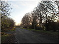
Section of former A15, Glinton
This short section of Lincoln Road to the south of Glinton was formerly part of the main A15 route into Peterborough. It was blocked off when the A15 Glinton bypass opened in February 1989 and is now a dead-end providing residents' access to three houses situated to the south of the roundabout.
Image: © Paul Bryan
Taken: 31 Dec 2015
0.03 miles
5

Crashed car on the A15 Werrington Parkway, Glinton
After being involved in a collision, this Renault Captur had been moved from the carriageway and temporarily placed in the bus stop on the southbound section of the A15 Werrington Parkway close to the junction with Lincoln Road, Glinton. It had been marked with "Police Aware" tape and had been removed by the time I passed the same spot on the following day. The airbags did not appear to have been deployed but hopefully the driver and any passengers had not been seriously injured.
Image: © Paul Bryan
Taken: 25 Apr 2024
0.05 miles
6

Section of former A15, Glinton
This short section of Lincoln Road to the south of Glinton was formerly part of the main A15 route into Peterborough. It was blocked off when the A15 Glinton bypass opened in February 1989 and is now a dead-end providing residents' access to three houses situated to the south of the roundabout.
Image: © Paul Bryan
Taken: 31 Dec 2015
0.06 miles
7

With the Delaine to Peterborough - south of Glinton
The rural nature of the route changes as it reaches the outskirts of the expanding City of Peterborough. With the expansion of Peterborough, the old A15 has been realigned and dualled all the way to the centre of the City. The Delaine bus will make only 4 more intermediate stops and will arrive in just 10 minutes, making it an attractive alternative to using the car.
See grid square discussion http://www.geograph.org.uk/discuss/index.php?&action=vthread&forum=5&topic=7047 and slide show http://www.geograph.org.uk/search.php?i=2189430
Image: © Alan Murray-Rust
Taken: 25 Jan 2008
0.06 miles
8
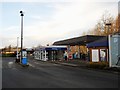
Glinton Service Station
The service station is located on the A15 Glinton bypass to the south of the village at the junction with Werrington Parkway. The bypass itself was opened in February 1989.
Image: © Paul Bryan
Taken: 31 Dec 2015
0.07 miles
9
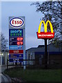
Sign at Glinton Service Station
The service station is located on the A15 Glinton bypass to the south of the village at the junction with Werrington Parkway. The bypass itself was opened in February 1989.
Image: © Paul Bryan
Taken: 31 Dec 2015
0.08 miles
10

Glinton service station, A15 northbound
Image: © Peter Robinson
Taken: 14 Oct 2011
0.09 miles